Category:SVG maps of the Weimar Republic
Jump to navigation
Jump to search
Subcategories
This category has the following 2 subcategories, out of 2 total.
Media in category "SVG maps of the Weimar Republic"
The following 33 files are in this category, out of 33 total.
-
 Weimar Republic 1930.svg 450 × 456; 483 KB
-
 Weimar Republic location.svg 2,845 × 2,737; 784 KB
-
 Cambios territoriales de Alemania (1919-1990).svg 976 × 818; 379 KB
-
 Danzig 1939 EN.svg 696 × 599; 32 KB
-
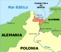 Danzig 1939 ES.svg 696 × 599; 43 KB
-
 DeutscheLandverluste-HE.svg 730 × 550; 62 KB
-
 DeutscheLandverluste.svg 730 × 550; 61 KB
-
 Deutsches Reich Preuss.svg 907 × 742; 810 KB
-
 German Empire 1937 adm location map.svg 1,425 × 1,133; 763 KB
-
 German Reich (1919–1933).svg 1,000 × 800; 369 KB
-
 German territorial losses 1919 and 1945.svg 512 × 429; 380 KB
-
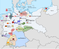
 Germanborders (ru).svg 730 × 550; 218 KB
-
 Germanborders-es.svg 730 × 550; 64 KB
-
 Germanborders.svg 730 × 550; 75 KB
-
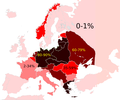
 Holocaust Jewish death toll %.svg 2,000 × 2,027; 983 KB
-
 Holocaustdeathtoll%.png 2,457 × 2,049; 1.29 MB
-

-

-
 Länder der Weimarer Republik.svg 976 × 818; 877 KB
-
 Pertes territoriales allemagne 1919 1945-es.svg 730 × 550; 343 KB
-
 Pertes territoriales allemagne 1919 1945.svg 730 × 550; 91 KB
-
 Карта государств Германской Империи (1919-1937).svg 976 × 818; 523 KB
-
 Thüringen 1920.svg 1,400 × 1,000; 46 KB
-
 Vajmara Respubliko mapo.svg 976 × 818; 969 KB
-
 Vajmara Respubliko mapo2.svg 976 × 818; 969 KB
-
 Weimar Republic blank map.svg 1,425 × 1,133; 967 KB
-
 Weimar Republic states and provinces.svg 940 × 750; 581 KB
-
 Weimar Republic states map mk.svg 976 × 818; 1.07 MB
-
 Weimar Republic states map-es.svg 976 × 818; 1.12 MB
-
 Weimar Republic states map-sr.svg 976 × 818; 950 KB
-
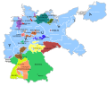
 Weimar Republic states map.svg 976 × 818; 949 KB
-
 Weimarer Republik 1920.svg 940 × 750; 588 KB
-
 Weimarer Republik 1925-es.svg 940 × 750; 794 KB


.svg)


.svg)

.svg)


.svg)


