Category:SVG maps of the Republic of China
Jump to navigation
Jump to search
English: This category consists of the SVG maps of China as claimed by Taiwan. For the historical Republic of China, see Maps of the Republic of China (1912–1949).
Subcategories
This category has the following 2 subcategories, out of 2 total.
L
Media in category "SVG maps of the Republic of China"
The following 21 files are in this category, out of 21 total.
-
 China in 1950.svg 1,181 × 940; 2.16 MB
-
 China in 1952.svg 1,181 × 940; 2.1 MB
-
 China in 1954.svg 1,181 × 940; 1.99 MB
-
 China in 1968.svg 1,181 × 940; 1.99 MB
-
 China in 1979.svg 1,181 × 940; 2.02 MB
-
 Coat of arms of the Republic of China Marine Corps.svg 557 × 613; 58 KB
-
 Country-level map of the China region.svg 1,000 × 850; 58 KB
-
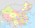
 ROC Administrative and Claims-de.svg 933 × 737; 531 KB
-
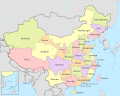
 ROC Administrative and Claims-es.svg 754 × 600; 673 KB
-
 ROC Administrative and Claims-ja.svg 847 × 674; 727 KB
-
 ROC Administrative and Claims.svg 754 × 600; 676 KB
-
 ROC Administrative Subdivisions zh-hant.svg 677 × 535; 306 KB
-
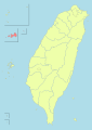
 ROC Div Taiwan.svg 677 × 535; 460 KB
-
 ROC outline.svg 681 × 544; 386 KB
-
 ROC vs PRC Consistant Romanization.svg 1,339 × 918; 1.71 MB
-
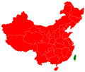
 ROC vs PRC.svg 512 × 351; 1.35 MB
-
 Taiwan ROC political division map Kinmen Fukien.svg 512 × 723; 309 KB
-
 Taiwan ROC political division map Lienchiang County Fukien.svg 512 × 723; 309 KB
-
 Zhonghua Minguo Quhua Fanti.svg 847 × 674; 724 KB
-
 中華民國時區.svg 512 × 401; 2.34 MB
-
 空白中華民國全圖.svg 512 × 407; 2.59 MB


