Category:SVG maps of regions of France and their historical provinces
Jump to navigation
Jump to search
Media in category "SVG maps of regions of France and their historical provinces"
The following 15 files are in this category, out of 15 total.
-
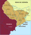 County of nice-es.svg 584 × 670; 497 KB
-
 County of nice.svg 584 × 670; 197 KB
-
 Broioù kozh breizh.svg 946 × 724; 734 KB
-
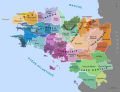 France Pays bretons map.svg 946 × 724; 1,017 KB
-
 Location map of Maine, France.svg 3,007 × 2,107; 260 KB
-
 Location map of the Pays de la Loire region, France.svg 1,546 × 1,497; 906 KB
-
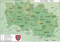 Carte maine.svg 1,813 × 1,255; 3.76 MB
-
 Map fr duchy of Gascony 1150-es.svg 713 × 590; 332 KB
-
 Map fr duchy of Gascony 1150-ru.svg 713 × 590; 93 KB
-
 Map fr duchy of Gascony 1150.svg 713 × 590; 447 KB
-
 Map of kingdom of Arles-es.svg 5,382 × 7,087; 1.74 MB
-
 Provence-Alpes-Cote d'azur Provence.svg 2,732 × 2,367; 163 KB
-
 Provence-Alpes-Cote d'azur Provinces.svg 2,732 × 2,367; 162 KB
-
 Relief map of Maine, France.svg 3,007 × 2,107; 427 KB
-
 Rivière-Basse en Gascogne.svg 2,008 × 1,507; 109 KB


