Category:SVG maps of regions of Chile
Jump to navigation
Jump to search
Subcategories
This category has only the following subcategory.
Media in category "SVG maps of regions of Chile"
The following 44 files are in this category, out of 44 total.
-

-

-
 ChileRegions (+Numbers).svg 229 × 1,067; 1.08 MB
-
 ChileRegions (without Numbers).svg 229 × 1,067; 1.06 MB
-
 I Tarapacá.svg 600 × 800; 22 KB
-
 II Antofagasta.svg 600 × 900; 24 KB
-
 III Atacama.svg 600 × 800; 45 KB
-
 IV Coquimbo.svg 600 × 800; 62 KB
-
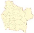 IX Araucanía.svg 500 × 474; 564 KB
-
 Mapa loc Aisén.svg 400 × 600; 1.32 MB
-
 Mapa loc Antofagasta.svg 400 × 600; 1.13 MB
-
 Mapa loc Antártica.svg 400 × 600; 1.22 MB
-
 Mapa loc Araucanía.svg 400 × 600; 1.16 MB
-
 Mapa loc Arica y Parinacota.svg 400 × 600; 1.12 MB
-
 Mapa loc Atacama.svg 400 × 600; 1.13 MB
-
 Mapa loc Biobío.svg 400 × 600; 1.2 MB
-
 Mapa loc Coquimbo.svg 400 × 600; 1.13 MB
-
 Mapa loc Los Lagos.svg 400 × 600; 1.26 MB
-
 Mapa loc Los Ríos.svg 400 × 600; 1.15 MB
-
 Mapa loc Magallanes.svg 400 × 600; 1.48 MB
-
 Mapa loc Maule.svg 400 × 600; 1.17 MB
-
 Mapa loc Metropolitana.svg 400 × 600; 1.15 MB
-
 Mapa loc O'Higgins.svg 400 × 600; 1.15 MB
-
 Mapa loc Tarapacá.svg 400 × 600; 1.13 MB
-
 Mapa loc Valparaíso.svg 400 × 600; 1.15 MB
-
 Mapa loc Ñuble.svg 400 × 600; 1.17 MB
-
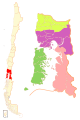
 Mapa O'Higgins y Maule.svg 400 × 600; 1.07 MB
-
 Mapa Regiones de Chile.svg 288 × 640; 992 KB
-
 Mapa-chile.svg 512 × 1,048; 604 KB
-
 Mapa-region-del-bio-bio.svg 800 × 850; 549 KB
-
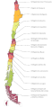
 Natural Regions of Chile.svg 1,183 × 2,658; 1.16 MB
-
 Región Metropolitana.svg 600 × 500; 148 KB
-
 V Valparaiso.svg 481 × 596; 100 KB
-
 VI O'Higgins.svg 600 × 500; 228 KB
-
 VII Maule.svg 600 × 550; 476 KB
-
 VIII Biobío.svg 800 × 700; 318 KB
-
 X Los Lagos-colored.svg 400 × 600; 117 KB
-
 X Los Lagos.svg 400 × 600; 263 KB
-
 XI Aisén.svg 450 × 600; 256 KB
-
 XII Magallanes-colored.svg 400 × 600; 128 KB
-
 XII Magallanes.svg 800 × 950; 328 KB
-
 XIV Los Ríos.svg 600 × 500; 103 KB
-
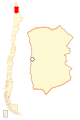
 XV Arica-Parinacota.svg 600 × 500; 15 KB
-
 XVI Ñuble.svg 587 × 459; 229 KB

,_administrative_divisions_(CORFO_regions)_-_Nmbrs_-_colored_2018.svg)


.svg)
.svg)