Category:SVG maps of metropolitan areas in Brazil
Jump to navigation
Jump to search
Media in category "SVG maps of metropolitan areas in Brazil"
The following 102 files are in this category, out of 102 total.
-
 Aglomeração Urbana Central.svg 1,020 × 638; 600 KB
-
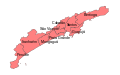
 Aglomeração Urbana de Franca, Grande Franca.svg 1,020 × 638; 598 KB
-
 Agrupamento Urbano de Bauru.svg 1,020 × 638; 601 KB
-
 Alagoas MetropolitanRegions.svg 1,261 × 677; 123 KB
-
 Alagoas RM Agreste.svg 1,261 × 677; 648 KB
-
 Alagoas RM Caetés.svg 1,261 × 677; 122 KB
-
 Alagoas RM Médio Sertão.svg 1,261 × 677; 122 KB
-
 Alagoas RM Palmeira dos Índios.svg 1,261 × 677; 122 KB
-
 Alagoas RM Sertão.svg 1,261 × 677; 122 KB
-
 Alagoas RM São Francisco.svg 1,261 × 677; 122 KB
-
 Alagoas RM Vale do Paraíba.svg 1,261 × 677; 122 KB
-
 Alagoas RM Zona da Mata.svg 1,261 × 677; 122 KB
-
 Regiões metropolitanas da Bahia.svg 886 × 918; 490 KB
-
 BahiaPernambuco RIDE PoloPetrolinaeJuazeiro.svg 539 × 686; 1.03 MB
-
 SaoPaulo RM BaixadaSantista.svg 1,020 × 638; 602 KB
-
 Brazil Para e Amapá Delta do Amazonas RM Macapá e Belém.svg 1,023 × 1,130; 663 KB
-
 SaoPaulo RM Campinas.svg 1,020 × 638; 578 KB
-
 Ceara RM Cariri.svg 581 × 684; 222 KB
-
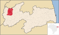
 Parana RM Curitiba.svg 1,540 × 990; 571 KB
-
 EspiritoSanto Metro Vitoria.svg 677 × 986; 244 KB
-
 Bahia RM FeiradeSantana AreadeExpansao.svg 659 × 691; 448 KB
-
 Bahia RM FeiradeSantana.svg 659 × 691; 447 KB
-
 Ceara RM Fortaleza.svg 581 × 684; 225 KB
-
 Goias RM Goiania.svg 710 × 693; 469 KB
-
 Parana RM Londrina.svg 1,540 × 990; 575 KB
-
 Alagoas RM Maceio.svg 1,261 × 677; 642 KB
-
 Amazonas RM Manaus.svg 985 × 691; 474 KB
-
 Mapa de Brasões da RMSP (Região Metropolitana de São Paulo, "Grande São Paulo").svg 1,000 × 600; 15.06 MB
-
 Mapa RMSalvador 1973.svg 1,000 × 505; 73 KB
-
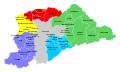
 Mapa RMSalvador evolução territorial.svg 1,000 × 505; 80 KB
-
 Mapa RMSalvador legendas.svg 1,000 × 505; 87 KB
-
 Mapa-MVPP-RMVPLN.svg 1,000 × 700; 94 KB
-
 Mapa-RMBS.svg 800 × 500; 19 KB
-
 Mapa-RMC.svg 665 × 625; 27 KB
-
 Mapa-RMSP-subregions.svg 1,000 × 600; 72 KB
-
 Mapa-RMSP-subregions2.svg 1,000 × 600; 40 KB
-
 Mapa-RMSP.svg 1,000 × 600; 72 KB
-
 Maranhao Metro SaoLuis.svg 758 × 990; 392 KB
-
 Maranhao Metro SudoesteMaranhense.svg 758 × 990; 383 KB
-
 Maranhao MetropolitanRegions.svg 758 × 990; 388 KB
-
 Parana RM Maringa 2012.svg 1,540 × 990; 529 KB
-
 MatoGrosso Metro ValeRioCuiaba.svg 1,070 × 988; 494 KB
-
 MatoGrosso RM ValeRioCuiaba.svg 1,070 × 988; 495 KB
-
 MinasGerais Metro BeloHorizonte.svg 914 × 709; 1.14 MB
-
 MinasGerais Metro ValedoAco.svg 914 × 709; 1.05 MB
-
 MinasGerais RM ValedoAco.svg 914 × 709; 1.18 MB
-
 Mapa da Região Metropolitana de Natal.svg 620 × 1,050; 13 KB
-
 Municípios da Região Metropolitana de Natal.svg 620 × 1,050; 19 KB
-
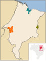
 Natal, municípios limítrofes e região metropolitana.svg 620 × 1,050; 19 KB
-
 Para RM Maraba.svg 1,024 × 990; 824 KB
-
 Paraiba RM Araruna.svg 1,680 × 990; 199 KB
-
 Paraiba RM BarradeSantaRosa.svg 1,680 × 990; 200 KB
-
 Paraiba RM Cajazeiras.svg 1,680 × 990; 201 KB
-
 Paraiba RM CampinaGrande.svg 1,680 × 990; 203 KB
-
 Paraiba RM Guarabira.svg 1,680 × 990; 232 KB
-
 Paraiba RM Itabaiana.svg 1,680 × 990; 200 KB
-
 Paraiba RM JoaoPessoa.svg 1,680 × 990; 197 KB
-
 Paraiba RM Patos.svg 1,680 × 990; 201 KB
-
 Paraiba RM Sousa.svg 1,680 × 990; 200 KB
-
 Paraiba RM ValedoMamanguape.svg 1,680 × 990; 200 KB
-
 Paraiba RM ValedoPianco.svg 1,680 × 990; 200 KB
-
 Parana RM Apucarana.svg 1,540 × 990; 575 KB
-
 Parana RM CampoMourao.svg 1,540 × 990; 576 KB
-
 Parana RM Cascavel.svg 1,540 × 990; 575 KB
-
 Parana RM Maringa 2014.svg 1,540 × 990; 509 KB
-
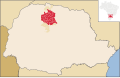
 Parana RM Maringa.svg 1,540 × 990; 575 KB
-
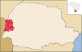 Parana RM Toledo.svg 1,540 × 990; 575 KB
-
 Parana RM Umuarama.svg 1,540 × 990; 575 KB
-
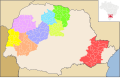 Parana RM.svg 1,540 × 990; 576 KB
-
 PB RegioesMetropolitanas.svg 1,680 × 990; 232 KB
-
 Piaui RM Parnaíba.svg 800 × 1,081; 2.4 MB
-
 Região Metropolitana de Porto Alegre, Rio Grande do Sul.svg 716 × 691; 814 KB
-
 RioGrandedoSul RM PortoAlegre.svg 1,095 × 946; 918 KB
-
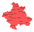
 Região Metropolitana de Piracicaba, Grande Piracicaba.svg 1,020 × 638; 596 KB
-
 Região Metropolitana de São José do Rio Preto, Grande Rio Preto.svg 1,020 × 638; 595 KB
-
 SaoPaulo RM RibeiraoPreto.svg 1,020 × 638; 678 KB
-
 Rio de Janeiro Regiao Metropolitana 2014 modified.svg 960 × 691; 214 KB
-
 RioGrandedoNorte RM Natal.svg 1,594 × 990; 138 KB
-
 RioGrandedoSul RM SerraGaúcha.svg 1,095 × 946; 639 KB
-
 Rondonia RM PortoVelho.svg 819 × 687; 229 KB
-
 Roraima MetropolitanRegions.svg 624 × 687; 166 KB
-
 Roraima RM BoaVista.svg 624 × 687; 166 KB
-
 Roraima RM Central.svg 624 × 687; 165 KB
-
 Roraima RM SuldeRoraima.svg 624 × 687; 166 KB
-
 Bahia RM Salvador.svg 800 × 830; 18.5 MB
-
 SantaCatarina MetropolitanAreas.svg 943 × 691; 362 KB
-
 SantaCatarina RM AltoValedoItajaí.svg 943 × 691; 350 KB
-
 SantaCatarina RM Carbonífera.svg 943 × 691; 361 KB
-
 SantaCatarina RM Florianópolis.svg 943 × 691; 350 KB
-
 SantaCatarina RM FozdoRioItajaí.svg 943 × 691; 349 KB
-
 SantaCatarina RM NorteNordesteCatarinense.svg 943 × 691; 350 KB
-
 SantaCatarina RM Tubarão.svg 943 × 691; 360 KB
-
 SantaCatarina RM ValedoItajaí.svg 943 × 691; 349 KB
-
 Grande SaoPaulo.svg 1,020 × 638; 610 KB
-
 SaoPaulo MetropolitanAreas.svg 1,020 × 638; 694 KB
-
 SaoPaulo RM SaoPaulo MesoMicro.svg 1,020 × 638; 1.08 MB
-
 SaoPaulo RM SaoPaulo.svg 1,020 × 638; 603 KB
-
 SaoPaulo RM Sorocaba.svg 1,020 × 638; 590 KB
-
 Sergipe RM Aracaju.svg 656 × 684; 589 KB
-
 Tocantins RM Gurupi.svg 617 × 986; 435 KB
-
 Tocantins RM Palmas.svg 617 × 986; 324 KB
-
 SaoPaulo RM ValedoParaibaeLitoralNorte.svg 1,020 × 638; 588 KB


.svg)


