Category:SVG maps of local government areas in Tasmania
Jump to navigation
Jump to search
Subcategories
This category has only the following subcategory.
Media in category "SVG maps of local government areas in Tasmania"
The following 26 files are in this category, out of 26 total.
-
 Break O'Day LGA Tasmania locator map.svg 780 × 957; 209 KB
-
 Burnie City LGA Tasmania locator map with inset.svg 780 × 957; 400 KB
-
 Burnie City LGA Tasmania locator map.svg 780 × 957; 191 KB
-
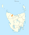
 Central Coast LGA Tasmania locator map.svg 780 × 957; 195 KB
-
 Central Highlands LGA Tasmania locator map.svg 780 × 957; 208 KB
-
 Circular Head LGA Tasmania locator map.svg 780 × 957; 209 KB
-
 Derwent Valley LGA Tasmania locator map.svg 780 × 957; 205 KB
-
 Devonport City LGA Tasmania locator map inset.svg 780 × 957; 390 KB
-
 Devonport City LGA Tasmania locator map.svg 780 × 957; 192 KB
-
 Dorset LGA Tasmania locator map.svg 780 × 957; 196 KB
-
 Flinders LGA Tasmania locator map.svg 780 × 957; 237 KB
-
 George Town LGA Tasmania locator map.svg 780 × 957; 196 KB
-
 Glamorgan Spring Bay LGA Tasmania locator map.svg 780 × 957; 221 KB
-
 Huon Valley LGA Tasmania locator map.svg 780 × 957; 223 KB
-
 Kentish LGA Tasmania locator map.svg 780 × 957; 194 KB
-
 King Island LGA Tasmania locator map.svg 780 × 957; 194 KB
-
 Latrobe LGA Tasmania locator map.svg 780 × 957; 196 KB
-
 Launceston City LGA Tasmania locator map.svg 780 × 957; 195 KB
-
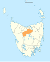 Meander Valley LGA Tasmania locator map.svg 780 × 957; 197 KB
-
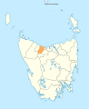
 Northern Midlands LGA Tasmania locator map.svg 780 × 957; 205 KB
-
 Sorell LGA Tasmania locator map.svg 780 × 957; 198 KB
-
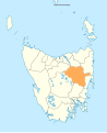
 Southern Midlands LGA Tasmania locator map.svg 780 × 957; 200 KB
-
 Tasman LGA Tasmania locator map.svg 780 × 957; 205 KB
-
 Waratah-Wynyard LGA Tasmania locator map.svg 780 × 957; 193 KB
-
 West Coast LGA Tasmania locator map.svg 780 × 957; 214 KB
-
 West Tamar LGA Tasmania locator map.svg 780 × 957; 196 KB


