Category:SVG maps of historical provinces of France by region
Jump to navigation
Jump to search
Media in category "SVG maps of historical provinces of France by region"
The following 9 files are in this category, out of 9 total.
-
Alsace-Champagne-Ardenne-Lorraine et provinces.svg 1,807 × 1,366; 2.45 MB
-
Aquitaine-Limousin-Poitou-Charentes et provinces.svg 1,063 × 1,446; 2.7 MB
-
Auvergne-Rhône-Alpes et provinces.svg 1,878 × 1,342; 2.24 MB
-
Bourgogne-Franche-Comté et provinces.svg 1,574 × 1,007; 1.88 MB
-
Hauts-de-France.svg 1,417 × 1,509; 1.89 MB
-
Languedoc-Roussillon-Midi-Pyrénées et provinces.svg 886 × 609; 2.59 MB
-
Lorraine et anciennes provinces.svg 3,055 × 2,977; 1.24 MB
-
Normandie et provinces.svg 2,526 × 1,875; 1.51 MB
-
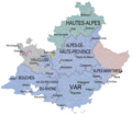
Provence-Alpes-Cote d'azur et provinces.png 2,041 × 1,786; 1.19 MB


