Category:SVG maps of historic counties of Northern Ireland in Sect 2
Jump to navigation
Jump to search
Media in category "SVG maps of historic counties of Northern Ireland in Sect 2"
The following 6 files are in this category, out of 6 total.
-
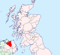
 Antrim Brit Isles Sect 2.svg 915 × 841; 1,004 KB
-
 Armagh Brit Isles Sect 2.svg 915 × 841; 1,004 KB
-
 Down Brit Isles Sect 2.svg 915 × 841; 1,004 KB
-
 Fermanagh Brit Isles Sect 2.svg 915 × 841; 1,004 KB
-
 Londonderry Brit Isles Sect 2.svg 915 × 841; 1,004 KB
-
 Tyrone Brit Isles Sect 2.svg 915 × 841; 1,004 KB


