Category:SVG maps of districts of Panama
Jump to navigation
Jump to search
Media in category "SVG maps of districts of Panama"
The following 25 files are in this category, out of 25 total.
-
 Centro Ciudad de Panama.svg 1,286 × 1,537; 183 KB
-
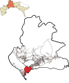
 Ciudad de la Chorrera (Ubicación).svg 1,358 × 1,533; 164 KB
-
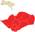
 Distrito de Arraiján.svg 1,257 × 1,483; 147 KB
-
 Distrito de la Chorrera (Ubicación).svg 1,156 × 1,599; 166 KB
-
 Distrito de Panamá Ubicación.svg 1,506 × 1,742; 159 KB
-
 Distrito de Panamá-Ubicación.svg 1,505 × 1,742; 151 KB
-
 Distrito de San Miguelito.svg 1,353 × 1,232; 138 KB
-
 Division Politica Capira.svg 1,718 × 1,258; 128 KB
-
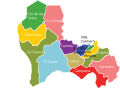
 División de Arraiján.svg 1,251 × 1,357; 150 KB
-
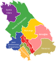
 División de La Chorrera.svg 1,189 × 1,403; 142 KB
-
 División San Miguelito.svg 1,775 × 1,035; 122 KB
-
 El Coco de la Chorrera (Ubicación).svg 1,358 × 1,533; 71 KB
-
 La Chorrera Arraiján San Miguelito y Panamá.svg 1,387 × 1,189; 312 KB
-
 Mapa político de Las Tablas - Los Santos.svg 594 × 628; 161 KB
-
 Mapa político de Macaracas.svg 601 × 542; 103 KB
-
 Mapa político de Pedasí.svg 712 × 768; 123 KB
-
 Mapa político de Pocrí - Los Santos.svg 468 × 630; 111 KB
-
 Mapa político de Tonosí.svg 780 × 518; 174 KB
-
 Mapa político del distrito de Guararé.svg 490 × 630; 93 KB
-
 Mapa político del distrito de Los Santos.svg 1,878 × 1,767; 119 KB
-
 Relieve de la Ciudad de Panamá.png 769 × 818; 533 KB
-
 Ríos Ciudad de Panamá.svg 734 × 775; 140 KB
-
 San Miguelito.svg 1,505 × 878; 496 KB
-
 Ubicación de El Coco de la Chorrera.svg 1,299 × 1,534; 139 KB
-
 Ubicación de la Ciudad de la Chorrera.svg 1,358 × 1,533; 164 KB

.svg)

.svg)


.svg)


