Category:SVG maps of cantons of Costa Rica
Jump to navigation
Jump to search
Subcategories
This category has the following 7 subcategories, out of 7 total.
Media in category "SVG maps of cantons of Costa Rica"
The following 8 files are in this category, out of 8 total.
-
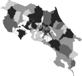
 Cantones de Costa Rica.svg 306 × 284; 2.27 MB
-
 COVID-19 Outbreak Cases in Costa Rica by cantons totals.svg 306 × 284; 159 KB
-
 COVID-19 outbreak Costa Rica per capita cases map.svg 306 × 284; 159 KB
-
 COVID-19 Outbreak Deaths in Costa Rica by canton.svg 306 × 284; 159 KB
-
 COVID-19 Vaccination map of Costa Rica by cantons totals.svg 306 × 284; 159 KB
-
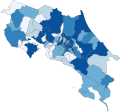
 Mapa de cantones de Costa Rica (Ago 2020).svg 306 × 284; 2.22 MB
-
 Mapa de Costa Rica (cantones y distritos).svg 666 × 598; 4.87 MB
-
 Mapa Distrital Coloreado de Costa Rica.svg 512 × 484; 4.01 MB


.svg)
.svg)
