Category:SVG maps of Zimbabwe
Jump to navigation
Jump to search
Subcategories
This category has the following 4 subcategories, out of 4 total.
Media in category "SVG maps of Zimbabwe"
The following 26 files are in this category, out of 26 total.
-
 2008 Zimbabwe Cholera Outbreak Combined.svg 630 × 490; 246 KB
-
 2008 Zimbabwe Cholera Outbreak.svg 630 × 490; 247 KB
-
 Administrative Divisions of Zimbabwe-es.svg 630 × 490; 279 KB
-
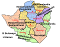
 Administrative Divisions of Zimbabwe.svg 630 × 490; 308 KB
-
 Blank Zimbabwe Map.svg 630 × 490; 237 KB
-
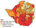 Food insecurity in Zimbabwe.svg 630 × 490; 295 KB
-
 Karte Schienennetz Simbabwe.svg 832 × 754; 271 KB
-
 LocationZimbabwe.svg 1,000 × 500; 2.76 MB
-
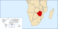
 Locator map of Zimbabwe in Africa.svg 1,000 × 1,000; 188 KB
-
 Mashonaland - Zimbabwe.svg 832 × 755; 239 KB
-
 Mashonaland.svg 250 × 228; 30 KB
-
 Matabeleland (adm).svg 672 × 523; 29 KB
-
 Matabeleland - Zimbabwe.svg 832 × 755; 239 KB
-
 Matabeleland.svg 250 × 228; 30 KB
-
 Rhodesia adm location map with names.svg 832 × 754; 183 KB
-
 Spread of Zimbabwean Cholera Outbreak.svg 1,000 × 500; 2.76 MB
-
 SVG-Koort Simbabwe.svg 425 × 400; 130 KB
-
 Zi-map-es.svg 832 × 754; 445 KB
-
 Zi-map-pt.svg 832 × 754; 450 KB
-
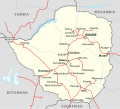
 Zimbabwe adm location map with names.svg 832 × 754; 186 KB
-
 Zimbabwe adm location map.svg 832 × 754; 184 KB
-
 Zimbabwe admin.svg 630 × 490; 852 KB
-
 Zimbabwe blank.svg 234 × 216; 16 KB
-
 Zimbabwe district map 2023.svg 512 × 440; 6.37 MB
-
 Zimbabwe districts with names.svg 805 × 710; 6.92 MB
-
 Zimbabwe haldusjaotus.svg 630 × 490; 317 KB


.svg)


