Category:SVG maps of South Asia
Jump to navigation
Jump to search
Subcategories
This category has the following 5 subcategories, out of 5 total.
Media in category "SVG maps of South Asia"
The following 8 files are in this category, out of 8 total.
-
 4 countries CN-IN-MM-PK.svg 200 × 200; 243 KB
-
 Hindko-speakers by Pakistani District - 2017 Census.svg 3,200 × 2,000; 2.43 MB
-
 India 1760-es.svg 2,151 × 2,546; 2.32 MB
-
 Indo-Aryan language map.svg 1,617 × 1,630; 1.78 MB
-
 Marathe-es.svg 1,594 × 1,868; 329 KB
-
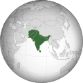 South Asia (excluding internal borders) (orthographic projection).svg 553 × 553; 285 KB
-
 South Asia (orthographic projection) without national boundaries.svg 550 × 550; 2.8 MB
-
 South Asia urban map.svg 512 × 576; 484 KB


_(orthographic_projection).svg)
_without_national_boundaries.svg)
