Category:SVG maps of Sergipe
Jump to navigation
Jump to search
Media in category "SVG maps of Sergipe"
The following 20 files are in this category, out of 20 total.
-
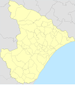
 Sergipe MesoMicroMunicip.svg 656 × 684; 767 KB
-
 Brazil Sergipe location map.svg 656 × 684; 103 KB
-
 Map brazil se.svg 553 × 615; 74 KB
-
 Mapa de casos de COVID-19 em Sergipe.svg 512 × 660; 96 KB
-
 Mapa de casos de COVID-19 por 100 mil habitantes em Sergipe.svg 512 × 660; 96 KB
-
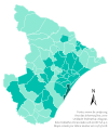 Mapa do IDH de Sergipe (2010).svg 512 × 605; 112 KB
-
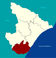
 Região Imediata de Aracaju, Sergipe.svg 982 × 1,024; 87 KB
-
 Região Imediata de Estância, Sergipe.svg 982 × 1,024; 86 KB
-
 Região Imediata de Itabaiana, Sergipe.svg 982 × 1,024; 87 KB
-
 Região Imediata de Lagarto, Sergipe.svg 982 × 1,024; 86 KB
-
 Região Imediata de Nossa Senhora da Glória, Sergipe.svg 982 × 1,024; 86 KB
-
 Região Imediata de Propriá, Sergipe.svg 982 × 1,024; 86 KB
-
 Região Intermediária de Aracaju, Sergipe.svg 982 × 1,024; 553 KB
-
 Região Intermediária de Itabaiana, Sergipe.svg 982 × 1,024; 311 KB
-
 Regiões Geográficas do Estado de Sergipe.svg 512 × 534; 132 KB
-
 Sergipe Köppen.svg 512 × 599; 93 KB
-
 Sergipe Municip maruim.svg 656 × 684; 790 KB
-
 Sergipe Municip MoitaBonita.svg 656 × 684; 788 KB
-
 Sergipe municip pinhao.svg 656 × 684; 791 KB
-
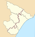
 Sergipe RM Aracaju.svg 656 × 684; 589 KB


.svg)


