Category:SVG maps of Nariño Department
Jump to navigation
Jump to search
Subcategories
This category has only the following subcategory.
Media in category "SVG maps of Nariño Department"
The following 18 files are in this category, out of 18 total.
-
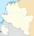
 Colombia - Nariño.svg 2,027 × 2,294; 636 KB
-
 Colombia Nariño location map (+locator map).svg 1,353 × 1,446; 538 KB
-
 Colombia Nariño location map (+urban areas +locator map).svg 1,353 × 1,446; 577 KB
-
 Colombia Nariño location map (+urban areas).svg 1,353 × 1,446; 384 KB
-
 Colombia Nariño location map (adm +urban areas +locator map).svg 1,353 × 1,446; 503 KB
-
 Colombia Nariño location map (adm +urban areas).svg 1,353 × 1,446; 311 KB
-
 Colombia Nariño location map (adm colored).svg 1,353 × 1,446; 505 KB
-
 Colombia Nariño location map (adm).svg 1,353 × 1,446; 272 KB
-
 Colombia Nariño location map 2 (+locator map).svg 1,353 × 1,446; 538 KB
-
 Colombia Nariño location map 2 (+urban areas +locator map).svg 1,353 × 1,446; 577 KB
-
 Colombia Nariño location map 2 (+urban areas).svg 1,353 × 1,446; 384 KB
-
 Colombia Nariño location map 2 (adm +urban areas +locator map).svg 1,353 × 1,446; 503 KB
-
 Colombia Nariño location map 2 (adm +urban areas).svg 1,353 × 1,446; 311 KB
-
 Colombia Nariño location map 2.svg 1,353 × 1,446; 345 KB
-
 Colombia Nariño location map.svg 1,353 × 1,446; 345 KB
-
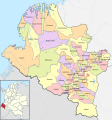 Mapa de Nariño (político).svg 1,353 × 1,446; 742 KB
-
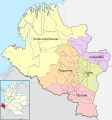 Mapa de Nariño (subregiones 2005).svg 1,353 × 1,446; 709 KB
-
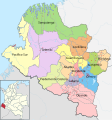 Mapa de Nariño (subregiones).svg 1,353 × 1,446; 714 KB

.svg)
.svg)
.svg)
.svg)
.svg)
.svg)
.svg)
.svg)
.svg)
.svg)
.svg)
.svg)


.svg)
.svg)
.svg)