Category:SVG maps of Mozambique
Jump to navigation
Jump to search
Subcategories
This category has the following 4 subcategories, out of 4 total.
Media in category "SVG maps of Mozambique"
The following 14 files are in this category, out of 14 total.
-
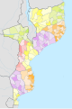 Districts of Mozambique.svg 1,134 × 1,706; 829 KB
-
 Mozambique adm location map.svg 1,134 × 1,706; 419 KB
-
 Mozambique adm-2 location map.svg 1,134 × 1,706; 545 KB
-
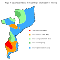 Mozambique map of Köppen climate classification-es.svg 1,900 × 1,900; 228 KB
-
 Portugala kolonia milito.png 661 × 738; 107 KB
-
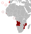 Portuguese colonial war blank map.svg 635 × 709; 514 KB
-
 Portuguese colonial war-ar.svg 677 × 756; 480 KB
-
 Portuguese colonial war-en.svg 635 × 709; 516 KB
-
 Portuguese colonial war-eo.svg 635 × 709; 516 KB
-
 Portuguese colonial war-es.svg 635 × 709; 517 KB
-
 Portuguese colonial war-fr.svg 635 × 709; 517 KB
-
 Portuguese colonial war-pl.svg 635 × 709; 516 KB
-
 Provinces of Mozambique with labels.svg 744 × 1,052; 49 KB
-
 Ruvuma River basin map.svg 794 × 528; 1.28 MB


