Category:SVG maps of Kolkata
Jump to navigation
Jump to search
Subcategories
This category has only the following subcategory.
S
Media in category "SVG maps of Kolkata"
The following 7 files are in this category, out of 7 total.
-
 2011 Kolkata literacy rate by Wards (bn).svg 512 × 479; 184 KB
-
 2011 Kolkata literacy rate by Wards (en).svg 512 × 479; 172 KB
-
 2011 Kolkata population density by Wards (bn).svg 512 × 479; 223 KB
-
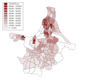 2011 Kolkata population density by Wards (en).svg 512 × 479; 187 KB
-
 Kolkata English Wikivoyage map.svg 419 × 523; 740 KB
-
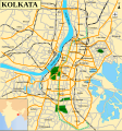 Kolkata Street Map.svg 600 × 640; 310 KB
-
 Kolkata Wikivoyage map.svg 744 × 1,052; 494 KB
.svg)
.svg)
.svg)
.svg)


