Category:SVG maps of Johor
Jump to navigation
Jump to search
Media in category "SVG maps of Johor"
The following 56 files are in this category, out of 56 total.
-
 Batu Pahat highlighted in Johor, Malaysia.svg 1,035 × 986; 78 KB
-
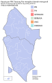
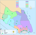 Districts and local authorities of Johor (blank) (zh).svg 1,035 × 986; 106 KB
-
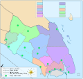 Districts and local authorities of Johor (blank).svg 1,035 × 986; 106 KB
-
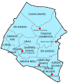
 Districts and PBT of Johor-zh.svg 1,035 × 986; 92 KB
-
 Districts and PBT of Johor.svg 1,035 × 986; 83 KB
-
 DUN Johor 2020.svg 1,186 × 891; 3.9 MB
-
 Flag map of Johor.svg 512 × 439; 23 KB
-
 Jelutong highlighted in Johor Bahru District, Malaysia.svg 512 × 410; 15 KB
-
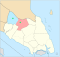
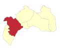
 Johor Bahru highlighted in Johor, Malaysia.svg 1,035 × 986; 78 KB
-
 Johor Bahru Mukim.svg 512 × 410; 12 KB
-
 Johor COVID-19 map.svg 744 × 709; 41 KB
-
 Johor location map.svg 1,035 × 986; 65 KB
-
 Kluang highlighted in Johor, Malaysia.svg 1,035 × 986; 78 KB
-
 Kota Tinggi highlighted in Johor, Malaysia.svg 1,035 × 986; 78 KB
-
 Kulai highlighted in Johor, Malaysia.svg 1,035 × 986; 78 KB
-
 Local authorities of Batu Pahat District, Johor.svg 1,035 × 986; 59 KB
-
 Local authorities of Kluang District, Johor.svg 1,035 × 986; 58 KB
-
 Local authorities of Kota Tinggi District, Johor.svg 1,035 × 986; 58 KB
-
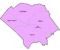
 Local authorities of Segamat District, Johor.svg 1,035 × 986; 58 KB
-
 Map of Batu Pahat District, Johor.svg 477 × 590; 63 KB
-
 Map of Iskandar Malaysia municipal governments.svg 499 × 414; 108 KB
-
 Map of Johor Bahru District, Johor.svg 754 × 547; 35 KB
-
 Map of Kluang District, Johor.svg 496 × 625; 33 KB
-
 Map of Kota Tinggi District, Johor.svg 641 × 609; 40 KB
-
 Map of Kulai District, Johor.svg 747 × 614; 25 KB
-
 Map of Mersing District, Johor.svg 1,146 × 586; 59 KB
-
 Map of Muar District, Johor.svg 577 × 629; 70 KB
-
 Map of Pontian District, Johor.svg 526 × 677; 45 KB
-
 Map of Segamat District, Johor.svg 802 × 642; 58 KB
-
 Map of Tangkak District, Johor.svg 593 × 688; 52 KB
-
 Mersing highlighted in Johor, Malaysia.svg 1,035 × 986; 78 KB
-
 Muar highlighted in Johor, Malaysia.svg 1,035 × 986; 78 KB
-
 Mukims of Johor labelled zh.svg 1,465 × 1,081; 740 KB
-
 Mukims of Johor labelled.svg 1,129 × 1,010; 3.98 MB
-
 Mukims of Kluang District, Johor.svg 644 × 825; 23 KB
-
 Mukims of Kota Tinggi District, Johor.svg 901 × 856; 32 KB
-
 Mukims of Kulai District, Johor.svg 1,439 × 1,020; 6 KB
-
 Mukims of Mersing District, Johor.svg 1,516 × 757; 61 KB
-
 Mukims of Muar District, Johor.svg 781 × 917; 41 KB
-
 Mukims of Pontian District, Johor.svg 476 × 610; 63 KB
-
 Mukims of Segamat District, Johor.svg 937 × 807; 63 KB
-
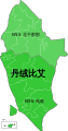
 Mukims of Tangkak District, Johor.svg 885 × 1,051; 44 KB
-
 P165 Tanjung Piai zh.svg 532 × 1,016; 74 KB
-
 P165 Tanjung Piai.svg 532 × 1,016; 74 KB
-
 Plentong highlighted in Johor Bahru District, Malaysia.svg 512 × 410; 122 KB
-
 Pontian highlighted in Johor, Malaysia.svg 1,035 × 986; 78 KB
-
 PRK Tanjung Piai result map.svg 1,130 × 1,780; 79 KB
-
 PRN Johor 2022.svg 1,186 × 891; 1.42 MB
-
 Pulai highlighted in Johor Bahru District, Malaysia.svg 512 × 410; 16 KB
-
 Segamat highlighted in Johor, Malaysia.svg 1,035 × 986; 78 KB
-
 Sungai Tiram highlighted in Johor Bahru District, Malaysia.svg 512 × 410; 121 KB
-
 Tangkak highlighted in Johor, Malaysia.svg 1,035 × 986; 78 KB
-
 Tanjung Kupang highlighted in Johor Bahru District, Malaysia.svg 512 × 410; 16 KB
-
 Tanjung Piai Parliament Map.svg 532 × 1,016; 71 KB
-
 Tebrau highlighted in Johor Bahru District, Malaysia.svg 512 × 410; 16 KB
-
 Zon MBIP.svg 512 × 288; 16 KB


_(zh).svg)
.svg)