
Category:SVG maps of Bangalore
Media in category "SVG maps of Bangalore"
The following 14 files are in this category, out of 14 total.
-
 A. Narayanapura ward map.svg 1,159 × 1,232; 102 KB
-
 Bangalore metro map.svg 2,607 × 2,519; 49 KB
-
 Bangalore Outline.svg 547 × 522; 35 KB
-
 Basavanapura ward map.svg 1,159 × 1,232; 102 KB
-
 Blr.svg 1,891 × 1,957; 25 KB
-
 Devasandra ward map.svg 1,159 × 1,232; 102 KB
-
 HAL Airport ward map.svg 1,159 × 1,232; 102 KB
-
 Horamavu ward map.svg 1,159 × 1,232; 103 KB
-
 Kr puram 2.svg 512 × 723; 362 KB
-
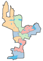
 KR Puram ward map.svg 1,159 × 1,232; 102 KB
-
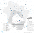 Lakes in Bangalore, BBMP, Urban district, Rural district.svg 6,441 × 6,286; 3.11 MB
-
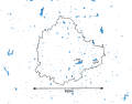 Lakes in Bangalore.svg 934 × 730; 2.12 MB
-
 Ramamurthy Nagar ward map.svg 1,159 × 1,232; 102 KB
-
 Vijnana Nagar ward map.svg 1,159 × 1,232; 102 KB


