Category:SVG maps of Atlántico Department
Jump to navigation
Jump to search
Subcategories
This category has only the following subcategory.
Media in category "SVG maps of Atlántico Department"
The following 22 files are in this category, out of 22 total.
-
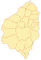
 Atlantico-municipios.svg 532 × 764; 105 KB
-
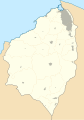
 Atlantico-nonames.svg 532 × 764; 77 KB
-
 Colombia - Atlántico.svg 2,027 × 2,294; 636 KB
-
 Colombia Atlántico location map (+locator map).svg 744 × 1,061; 297 KB
-
 Colombia Atlántico location map (+urban areas +locator map).svg 744 × 1,061; 313 KB
-
 Colombia Atlántico location map (+urban areas).svg 744 × 1,061; 120 KB
-
 Colombia Atlántico location map (adm +urban areas +locator map).svg 744 × 1,061; 264 KB
-
 Colombia Atlántico location map (adm +urban areas).svg 744 × 1,061; 72 KB
-
 Colombia Atlántico location map (adm colored).svg 744 × 1,061; 265 KB
-
 Colombia Atlántico location map 2 (+locator map).svg 744 × 1,061; 297 KB
-
 Colombia Atlántico location map 2 (+urban areas +locator map).svg 744 × 1,061; 313 KB
-
 Colombia Atlántico location map 2 (+urban areas).svg 744 × 1,061; 120 KB
-
 Colombia Atlántico location map 2 (adm +urban areas +locator map).svg 744 × 1,061; 264 KB
-
 Colombia Atlántico location map 2 (adm +urban areas).svg 744 × 1,061; 72 KB
-
 Colombia Atlántico location map 2.svg 744 × 1,061; 105 KB
-
 Colombia Atlántico location map.svg 744 × 1,061; 105 KB
-
 Colombia-atlantico.svg 462 × 699; 140 KB
-
 Elecciones 2007 Atlántico-alcaldía.svg 458 × 675; 64 KB
-
 Elecciones 2007 Atlántico-concejo.svg 458 × 675; 67 KB
-
 Mapa de Atlántico (subregiones 2005).svg 744 × 1,061; 327 KB
-
 Mapa de Atlántico (subregiones).svg 744 × 1,061; 353 KB
-
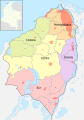
 Mapa del Atlántico (político).svg 744 × 1,061; 338 KB


.svg)
.svg)
.svg)
.svg)
.svg)
.svg)
.svg)
.svg)
.svg)
.svg)
.svg)


.svg)
.svg)
.svg)