Category:SVG maps by Ikonact
Jump to navigation
Jump to search
Media in category "SVG maps by Ikonact"
The following 98 files are in this category, out of 98 total.
-
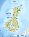 Auckland Islands New Zealand geographic map en.svg 1,800 × 2,274; 2.37 MB
-
 Austria-geographic map-blank.svg 2,060 × 1,200; 9.51 MB
-
 Blank Map France Bretagne communes.svg 980 × 750; 615 KB
-
 Blank Map of France with Communes 2017.svg 1,567 × 1,500; 12.31 MB
-
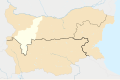
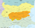 Bulgaria after unification political map-bg.svg 2,256 × 1,800; 3.01 MB
-
 Bulgaria after unification political map-en.svg 2,256 × 1,800; 3.01 MB
-
 Bulgaria average monthly wage geographical distribution.svg 2,400 × 1,520; 1.28 MB
-
 Bulgaria Bansko Municipality geographic map bg.svg 1,896 × 1,000; 4.27 MB
-
 Bulgaria Belitsa Municipality geographic map bg.svg 1,000 × 1,080; 3.64 MB
-
 Bulgaria Blagoevgrad Province topographic map.svg 550 × 500; 7.08 MB
-
 Bulgaria Distribution Ursus arctos.svg 2,483 × 1,642; 899 KB
-
 Bulgaria drainage divide.svg 2,483 × 1,642; 772 KB
-
 Bulgaria Ethnic composition Roma census 2011.svg 512 × 324; 3.07 MB
-
 Bulgaria Ethnic composition Turks census 2011 - ratio from total.svg 2,400 × 1,520; 3.07 MB
-
 Bulgaria Ethnic composition Turks census 2011.svg 512 × 324; 3.07 MB
-
 Bulgaria geographic map Belasitsa Ograzhden bg.svg 4,228 × 2,500; 10.06 MB
-
 Bulgaria geographic map borders of Balkan Mountains bg.svg 7,554 × 2,600; 5.49 MB
-
 Bulgaria geographic map Burgasvalley bg.svg 3,176 × 2,000; 10.12 MB
-
 Bulgaria geographic map Central Stara Planina bg.svg 5,992 × 2,000; 16.98 MB
-
 Bulgaria geographic map Danubian Plain Central bg.svg 3,048 × 2,000; 15.87 MB
-
 Bulgaria geographic map Eastern Stara Planina bg.svg 5,881 × 2,500; 13.07 MB
-
 Bulgaria geographic map Maleshevo Vlahina bg.svg 2,500 × 4,477; 11.47 MB
-
 Bulgaria geographic map NorthStrandzha bg.svg 3,641 × 2,000; 15.34 MB
-
 Bulgaria geographic map Osogovo bg.svg 3,339 × 2,500; 10.22 MB
-
 Bulgaria geographic map Rila bg.svg 4,294 × 3,000; 14.35 MB
-
 Bulgaria geographic map Sakar bg.svg 2,232 × 2,000; 6.57 MB
-
 Bulgaria geographic map Sakar en.svg 2,232 × 2,000; 6.28 MB
-
 Bulgaria geographic map Samokovvalley bg.svg 1,772 × 1,200; 7.25 MB
-
 Bulgaria geographic map SarnenaSrednaGora bg.svg 5,535 × 2,000; 13.85 MB
-
 Bulgaria geographic map SashtinskaSrednaGora bg.svg 3,112 × 2,000; 10.02 MB
-
 Bulgaria geographic map Slavyanka Stargatch Bozdag bg.svg 3,930 × 2,500; 8.92 MB
-
 Bulgaria geographic map Stara Planina bg.svg 7,551 × 3,075; 20.48 MB
-
 Bulgaria geographic map Tundzhahills bg.svg 2,425 × 2,000; 7.74 MB
-
 Bulgaria geographic map UpperThracianPlain bg.svg 5,259 × 2,000; 17.69 MB
-
 Bulgaria geographic map Western Stara Planina bg.svg 2,183 × 2,000; 18.89 MB
-
 Bulgaria geographic map Zavala Plana bg.svg 2,627 × 2,500; 14.55 MB
-
 Bulgaria in 1879 geographic map-bg.svg 2,256 × 1,800; 15.78 MB
-
 Bulgaria in 1885 geographic map-bg.svg 2,256 × 1,800; 15.14 MB
-
 Bulgaria in 1913 geographic map-bg.svg 2,256 × 1,800; 14.54 MB
-
 Bulgaria in 1915 geographic map-en.svg 2,256 × 1,800; 14.46 MB
-
 Bulgaria in 1919 geographic map-bg.svg 2,256 × 1,800; 14.67 MB
-
 Bulgaria location map drainage basin Iskar.svg 2,724 × 1,800; 11.88 MB
-
 Bulgaria Lovech Province topographic map bg.svg 1,684 × 1,200; 9.08 MB
-
 Bulgaria map drainage divide and river bassins.svg 2,724 × 1,800; 12.03 MB
-
 Bulgaria NUTS-2 Proposal 2018 variant 3.svg 512 × 324; 1,019 KB
-
 Bulgaria Pernik Province topographic map.svg 2,038 × 1,700; 5.92 MB
-
 Bulgaria Pirin mountain geographic map bg.svg 1,200 × 1,205; 6.75 MB
-
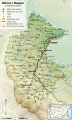
 Bulgaria railroads map bg.svg 1,642 × 1,036; 2.2 MB
-
 Bulgaria roads map bg.svg 1,642 × 1,036; 3.16 MB
-
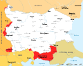
 Bulgaria unemployment geographical distribution.svg 2,400 × 1,520; 1.28 MB
-
 Bulgaria, after balkan wars 1913.svg 2,256 × 1,800; 2.13 MB
-
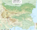
 Bulgaria-geographic map-en.svg 2,483 × 1,642; 3.96 MB
-
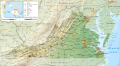
 Bulgaria-Kraishte-topographic-map-bg.svg 2,835 × 2,800; 8.98 MB
-
 Bulgaria-Oblast-Vidin-geographic-map-bg.svg 750 × 1,250; 1.71 MB
-
 Cambodia demographic map-provinces-fertilityrate-2014-en.svg 512 × 450; 567 KB
-
 Cambodia demographic map-provinces-percentualdistribution-2019-en.svg 512 × 450; 567 KB
-
 Cambodia demographic map-provinces-sexratio-2019-en.svg 512 × 450; 567 KB
-
 Cambodia Geographic map en.svg 1,466 × 1,280; 19.21 MB
-
 Campbell Island New Zealand geographic map en.svg 1,005 × 1,000; 755 KB
-
 Colorado geographic map-en.svg 2,581 × 2,200; 7.2 MB
-
 Corsica-geographic map-fr.svg 2,200 × 4,030; 14.15 MB
-
 Corsica-geographic map.svg 2,200 × 4,030; 14.24 MB
-
 Cyprus-topographic map-en.svg 2,028 × 1,642; 3.15 MB
-
 CzechRepublic-geographic map-en.svg 1,949 × 1,200; 14.56 MB
-
 Geographic map of Balkan Peninsula.svg 3,118 × 2,600; 13.82 MB
-
 Geographic map of Carpathian mountains.svg 3,283 × 2,800; 9.78 MB
-
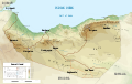 Geographic map of Somaliland.svg 4,110 × 2,600; 11.09 MB
-
 Grande Comore topographic map-fr.svg 1,200 × 1,708; 1.31 MB
-
 Guatemala-geographic map-blank.svg 2,000 × 2,232; 14.42 MB
-
 Hungary-geographic map-en.svg 1,855 × 1,200; 13.56 MB
-
 Louisiana geographic map-en.svg 2,396 × 2,200; 4.63 MB
-
 Map Bulgaria Septemvri–Dobrinishte narrow-gauge line.svg 2,486 × 2,000; 3.06 MB
-
 Map of Bulgaria after Bucharest Treaty 1913 South Dobruja-bg.svg 2,989 × 1,800; 8.72 MB
-
 Map of Bulgaria after Treaty of Neuilly-sur-Seine Bosilegrad region-bg.svg 1,200 × 1,626; 6.65 MB
-
 Map of Bulgaria after Treaty of Neuilly-sur-Seine Kula region.svg 1,200 × 1,363; 695 KB
-
 Map of Bulgaria after Treaty of Neuilly-sur-Seine Strumitsa region-bg.svg 2,912 × 2,292; 6.54 MB
-
 Map of Bulgaria after Treaty of Neuilly-sur-Seine Tsaribrod region-bg.svg 1,200 × 1,237; 4.12 MB
-
 Map of Bulgaria after Treaty of Neuilly-sur-Seine Western Thrace-bg.svg 1,921 × 1,500; 8.95 MB
-
 Map of Bulgaria after Treaty of Neuilly-sur-Seinе-en.svg 2,256 × 1,800; 1.71 MB
-
 Map of Rila Pirin Rhodopes en.svg 1,445 × 1,024; 6.59 MB
-
 Map of Vardar river basin-bg.svg 1,800 × 2,202; 7.62 MB
-
 Map of Еastern Thrace borders Bulgaria Ottoman empire 1912 1919-bg.svg 1,679 × 1,500; 10.55 MB
-
 Mediterranean Sea Bathymetry map.svg 4,252 × 2,000; 4.3 MB
-
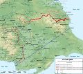
 National Parks in England and Wales.svg 990 × 1,181; 2.3 MB
-
 New York state geographic map-en.svg 2,811 × 2,000; 18.34 MB
-
 NorthMacedonia riverbassins blank.svg 2,270 × 1,800; 3.59 MB
-
 Oklahoma topographic map-en.svg 3,952 × 2,000; 14.9 MB
-
 Pannonian Basin geographic map.svg 3,186 × 2,600; 9.58 MB
-
 Provadiyska river map.svg 2,366 × 1,800; 2.92 MB
-
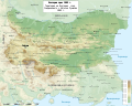
 Slovakia general relief map.svg 2,285 × 1,200; 6.08 MB
-
 Slovakia-geographic map-en.svg 2,285 × 1,200; 11.48 MB
-
 Snares Islands New Zealand geographic map en.svg 2,751 × 1,800; 195 KB
-
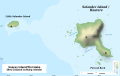 Solander Islands New Zealand geographic map en.svg 2,851 × 1,800; 91 KB
-
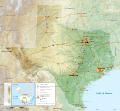 Texas topographic map-en.svg 2,164 × 2,000; 13.78 MB
-
 Three Kings Islands New Zealand geographic map en.svg 1,765 × 1,000; 944 KB
-
 Virginia geographic map-en.svg 3,641 × 2,000; 12.5 MB
-
 Wenro Territory ca1630 map-en.svg 2,300 × 1,700; 9.76 MB
-
 West Virginia geographic map-en.svg 2,250 × 2,000; 15.67 MB


