Category:SVG locator maps of the Democratic Republic of the Congo
Jump to navigation
Jump to search
Countries of Africa: Algeria · Angola · Benin · Botswana · Burkina Faso · Burundi · Cameroon · Cape Verde · Central African Republic · Chad · Comoros · Democratic Republic of the Congo · Republic of the Congo · Djibouti · Egypt‡ · Equatorial Guinea · Eritrea · Eswatini · Ethiopia · Gabon · The Gambia · Ghana · Guinea · Guinea-Bissau · Ivory Coast · Kenya · Lesotho · Liberia · Libya · Madagascar · Malawi · Mali · Mauritania · Morocco · Mozambique · Namibia · Niger · Nigeria · Rwanda · São Tomé and Príncipe · Senegal · Seychelles · Sierra Leone · Somalia · South Africa · South Sudan · Sudan · Tanzania · Togo · Tunisia · Uganda · Zambia · Zimbabwe
Limited recognition: Ambazonia · Sahrawi Arab Democratic Republic · Somaliland – Other areas: Canary Islands · Réunion · Western Sahara
‡: partly located in Africa
Limited recognition: Ambazonia · Sahrawi Arab Democratic Republic · Somaliland – Other areas: Canary Islands · Réunion · Western Sahara
‡: partly located in Africa
Subcategories
This category has only the following subcategory.
Media in category "SVG locator maps of the Democratic Republic of the Congo"
The following 7 files are in this category, out of 7 total.
-
 69346-Kongoko Errepublika Demokratikoa.svg 280 × 156; 153 KB
-

-
 Democraticrepublicofthecongo w1 locator.svg 1,000 × 1,000; 102 KB
-
 Democraticrepublicofthecongo w2 locator.svg 1,000 × 1,000; 224 KB
-
 Kongo und Uganda 2.svg 1,430 × 1,350; 664 KB
-
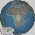
 Location Democratic Republic of the Congo AU Africa.svg 1,400 × 1,300; 2.17 MB
-
 LocationDemocraticRepublicoftheCongo.svg 1,000 × 500; 2.75 MB

_-_COD_-_UNOCHA.svg)


