Category:SVG locator maps of states in South Sudan (bright red location map scheme)
Jump to navigation
Jump to search

|
SVG maps in this category are part of a locator map series applying the (de) widespread location map scheme. Please see root category to browse for more. |
.svg)
.svg)
.svg)
.svg)
.svg)
.svg)
.svg)
Locator maps design recommendations ▼ | |
|---|---|
Principles
Design Guidelines are based on ▸location map design of the German map shop (in German). It's preferable to derive new locator maps from existing location maps. Please keep both size and ratio in this case. Thus the new locator maps may still be applied as location map (▸Guide). Marker color is supposed to be darkred. Waterbodies may be transparent, to show other objects better. Please be aware that this guide is only a recommendation. It’s not an inevitable law!
Highlight small areas
“Remote” areas and mini maps
Mini maps show where the depicted area actually is situated. Check out ▸Vorlage:Positionskarte+ (in German) and ▸Modèle:Carte en coin (in French) of how to insert a mini map in virtually every map.
Disputed areas
Greyed special objects
Backgrounds
|

-en.svg)

.svg)
.svg)
.svg)

_(US48).svg)
_(small_islands_magnified)_(-mini_map_-rivers).svg)
.svg)
_(extra_close)_(US48).svg)
.svg)
_(zoom).svg)

.svg)


_(UNMIK).svg)
.svg)
_(disputed_hatched).svg)
_(claimed_and_disputed_hatched).svg)
.svg)
.svg)
_(%2Ball_claims_hatched).svg)

.svg)
_(shade).svg)
_(shade)_(special_marker).svg)
_(-mini_map).svg)
_(-mini_map).svg)
_(-mini_map).svg)


.svg)

.svg)
Media in category "SVG locator maps of states in South Sudan (bright red location map scheme)"
The following 10 files are in this category, out of 10 total.
-
 Al-Buhayrat Map.svg 1,561 × 1,133; 208 KB
-
 Al-Wahda Map.svg 1,561 × 1,133; 209 KB
-
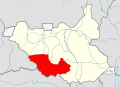
 Central Equatoria Map.svg 1,561 × 1,133; 210 KB
-
 Eastern Equatoria Map.svg 1,561 × 1,133; 208 KB
-
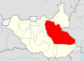 Jonglei Map.svg 1,561 × 1,133; 215 KB
-
 Northern Bahr el Ghazal Map.svg 1,561 × 1,133; 207 KB
-
 Upper Nile Map.svg 1,561 × 1,133; 211 KB
-
 Warrap Map.svg 1,561 × 1,133; 206 KB
-
 Western Bahr el Ghazal Map.svg 1,561 × 1,133; 213 KB
-
 Western Equatoria Map.svg 1,561 × 1,133; 214 KB


