Category:SVG locator maps of provinces in Cuba (red location map scheme)
Jump to navigation
Jump to search

|
SVG maps in this category are part of a locator map series applying the (de) widespread location map scheme. Please see root category to browse for more. |
.svg)
.svg)
.svg)
.svg)
.svg)
.svg)
.svg)
Locator maps design recommendations ▼ | |
|---|---|
Principles
Design Guidelines are based on ▸location map design of the German map shop (in German). It's preferable to derive new locator maps from existing location maps. Please keep both size and ratio in this case. Thus the new locator maps may still be applied as location map (▸Guide). Marker color is supposed to be darkred. Waterbodies may be transparent, to show other objects better. Please be aware that this guide is only a recommendation. It’s not an inevitable law!
Highlight small areas
“Remote” areas and mini maps
Mini maps show where the depicted area actually is situated. Check out ▸Vorlage:Positionskarte+ (in German) and ▸Modèle:Carte en coin (in French) of how to insert a mini map in virtually every map.
Disputed areas
Greyed special objects
Backgrounds
|

-en.svg)

.svg)
.svg)
.svg)

_(US48).svg)
_(small_islands_magnified)_(-mini_map_-rivers).svg)
.svg)
_(extra_close)_(US48).svg)
.svg)
_(zoom).svg)

.svg)


_(UNMIK).svg)
.svg)
_(disputed_hatched).svg)
_(claimed_and_disputed_hatched).svg)
.svg)
.svg)
_(%2Ball_claims_hatched).svg)

.svg)
_(shade).svg)
_(shade)_(special_marker).svg)
_(-mini_map).svg)
_(-mini_map).svg)
_(-mini_map).svg)


.svg)

.svg)
Media in category "SVG locator maps of provinces in Cuba (red location map scheme)"
The following 17 files are in this category, out of 17 total.
-
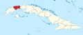 Artemisa in Cuba.svg 1,795 × 761; 1.13 MB
-
 Camaguey in Cuba.svg 1,795 × 761; 1.13 MB
-
 Ciego de Avila in Cuba.svg 1,795 × 761; 1.13 MB
-
 Cienfuegos in Cuba.svg 1,795 × 761; 1.13 MB
-
 Cuba (Pinar del Río Province).svg 800 × 340; 794 KB
-
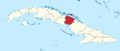
 Granma in Cuba.svg 1,795 × 761; 1.13 MB
-
 Guantanamo in Cuba.svg 1,795 × 761; 1.13 MB
-
 Holguin in Cuba.svg 1,795 × 761; 1.13 MB
-
 Isla de la Juventud in Cuba.svg 1,795 × 761; 1.13 MB
-
 La Habana in Cuba.svg 1,795 × 761; 1.13 MB
-
 Las Tunas in Cuba.svg 1,795 × 761; 1.13 MB
-
 Matanzas in Cuba.svg 1,795 × 761; 1.13 MB
-
 Mayabeque in Cuba.svg 1,795 × 761; 1.13 MB
-
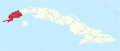
 Pinar del Rio in Cuba.svg 1,795 × 761; 1.13 MB
-
 Sancti Spiritus in Cuba.svg 1,795 × 761; 1.13 MB
-
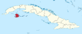
 Santiago de Cuba in Cuba.svg 1,795 × 761; 1.13 MB
-
 Villa Clara in Cuba.svg 1,795 × 761; 1.13 MB


.svg)


