Category:SVG locator maps of preserved counties in Wales (location map scheme)
Jump to navigation
Jump to search
Media in category "SVG locator maps of preserved counties in Wales (location map scheme)"
The following 10 files are in this category, out of 10 total.
-
 Comtés du pays de Galles (1974-1996).svg 981 × 1,173; 1.2 MB
-
 Comtés et districts du pays de Galles (1974-1996).svg 981 × 1,173; 2.42 MB
-
 Clwyd Preserved County in Wales.svg 1,047 × 1,252; 333 KB
-
 Dyfed Preserved County in Wales.svg 1,047 × 1,252; 333 KB
-
 Gwent Preserved County in Wales.svg 1,047 × 1,252; 333 KB
-
 Gwynedd Preserved County in Wales.svg 1,047 × 1,252; 333 KB
-
 Mid Glamorgan Preserved County in Wales.svg 1,047 × 1,252; 333 KB
-
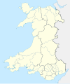
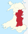 Powys Preserved County in Wales.svg 1,047 × 1,252; 333 KB
-
 South Glamorgan Preserved County in Wales.svg 1,047 × 1,252; 333 KB
-
 West Glamorgan Preserved County in Wales.svg 1,047 × 1,252; 333 KB
.svg)
.svg)


