Category:SVG locator maps of municipalities of Nariño Department
Jump to navigation
Jump to search
Media in category "SVG locator maps of municipalities of Nariño Department"
The following 64 files are in this category, out of 64 total.
-
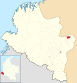
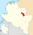
 Colombia - Nariño - Albán.svg 1,353 × 1,446; 505 KB
-
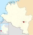
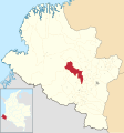
 Colombia - Nariño - Aldana.svg 1,353 × 1,446; 505 KB
-
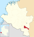
 Colombia - Nariño - Ancuya.svg 1,353 × 1,446; 505 KB
-
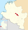
 Colombia - Nariño - Arboleda.svg 1,353 × 1,446; 505 KB
-
 Colombia - Nariño - Barbacoas.svg 1,353 × 1,446; 505 KB
-
 Colombia - Nariño - Belén.svg 1,353 × 1,446; 505 KB
-
 Colombia - Nariño - Buesaco.svg 1,353 × 1,446; 505 KB
-
 Colombia - Nariño - Chachagüí.svg 1,353 × 1,446; 505 KB
-
 Colombia - Nariño - Colón.svg 1,353 × 1,446; 505 KB
-
 Colombia - Nariño - Consacá.svg 1,353 × 1,446; 505 KB
-
 Colombia - Nariño - Contadero.svg 1,353 × 1,446; 505 KB
-
 Colombia - Nariño - Cuaspud.svg 1,353 × 1,446; 505 KB
-
 Colombia - Nariño - Cumbal.svg 1,353 × 1,446; 505 KB
-
 Colombia - Nariño - Cumbitara.svg 1,353 × 1,446; 505 KB
-
 Colombia - Nariño - Córdoba.svg 1,353 × 1,446; 505 KB
-
 Colombia - Nariño - El Charco.svg 1,353 × 1,446; 505 KB
-
 Colombia - Nariño - El Peñol.svg 1,353 × 1,446; 505 KB
-
 Colombia - Nariño - El Rosario.svg 1,353 × 1,446; 505 KB
-
 Colombia - Nariño - El Tablón.svg 1,353 × 1,446; 505 KB
-
 Colombia - Nariño - El Tambo.svg 1,353 × 1,446; 505 KB
-
 Colombia - Nariño - Francisco Pizarro.svg 1,353 × 1,446; 505 KB
-
 Colombia - Nariño - Funes.svg 1,353 × 1,446; 505 KB
-
 Colombia - Nariño - Guachucal.svg 1,353 × 1,446; 505 KB
-
 Colombia - Nariño - Guaitarilla.svg 1,353 × 1,446; 505 KB
-
 Colombia - Nariño - Gualmatán.svg 1,353 × 1,446; 505 KB
-
 Colombia - Nariño - Iles.svg 1,353 × 1,446; 505 KB
-
 Colombia - Nariño - Imués.svg 1,353 × 1,446; 505 KB
-
 Colombia - Nariño - Ipiales.svg 1,353 × 1,446; 505 KB
-
 Colombia - Nariño - La Cruz.svg 1,353 × 1,446; 505 KB
-
 Colombia - Nariño - La Florida.svg 1,353 × 1,446; 505 KB
-
 Colombia - Nariño - La Llanada.svg 1,353 × 1,446; 505 KB
-
 Colombia - Nariño - La Tola.svg 1,353 × 1,446; 505 KB
-
 Colombia - Nariño - La Unión.svg 1,353 × 1,446; 505 KB
-
 Colombia - Nariño - Leiva.svg 1,353 × 1,446; 505 KB
-
 Colombia - Nariño - Linares.svg 1,353 × 1,446; 505 KB
-
 Colombia - Nariño - Los Andes.svg 1,353 × 1,446; 505 KB
-
 Colombia - Nariño - Magüí Payán.svg 1,353 × 1,446; 505 KB
-
 Colombia - Nariño - Mallama.svg 1,353 × 1,446; 505 KB
-
 Colombia - Nariño - Mosquera.svg 1,353 × 1,446; 505 KB
-
 Colombia - Nariño - Nariño.svg 1,353 × 1,446; 505 KB
-
 Colombia - Nariño - Olaya Herrera.svg 1,353 × 1,446; 505 KB
-
 Colombia - Nariño - Ospina.svg 1,353 × 1,446; 505 KB
-
 Colombia - Nariño - Policarpa.svg 1,353 × 1,446; 505 KB
-
 Colombia - Nariño - Potosí.svg 1,353 × 1,446; 505 KB
-
 Colombia - Nariño - Providencia.svg 1,353 × 1,446; 505 KB
-
 Colombia - Nariño - Puerres.svg 1,353 × 1,446; 505 KB
-
 Colombia - Nariño - Pupiales.svg 1,353 × 1,446; 505 KB
-
 Colombia - Nariño - Ricaurte.svg 1,353 × 1,446; 505 KB
-
 Colombia - Nariño - Roberto Payán.svg 1,353 × 1,446; 505 KB
-
 Colombia - Nariño - Samaniego.svg 1,353 × 1,446; 505 KB
-
 Colombia - Nariño - San Bernardo.svg 1,353 × 1,446; 505 KB
-
 Colombia - Nariño - San Juan de Pasto.svg 1,353 × 1,446; 505 KB
-
 Colombia - Nariño - San Lorenzo.svg 1,353 × 1,446; 505 KB
-
 Colombia - Nariño - San Pablo.svg 1,353 × 1,446; 505 KB
-
 Colombia - Nariño - San Pedro de Cartago.svg 1,353 × 1,446; 505 KB
-
 Colombia - Nariño - Sandoná.svg 1,353 × 1,446; 505 KB
-
 Colombia - Nariño - Santa Bárbara.svg 1,353 × 1,446; 505 KB
-
 Colombia - Nariño - Santa Cruz.svg 1,353 × 1,446; 505 KB
-
 Colombia - Nariño - Sapuyes.svg 1,353 × 1,446; 505 KB
-
 Colombia - Nariño - Taminango.svg 1,353 × 1,446; 505 KB
-
 Colombia - Nariño - Tangua.svg 1,353 × 1,446; 505 KB
-
 Colombia - Nariño - Tumaco.svg 1,353 × 1,446; 505 KB
-
 Colombia - Nariño - Tuquerres.svg 1,353 × 1,446; 505 KB
-
 Colombia - Nariño - Yacuanquer.svg 1,353 × 1,446; 505 KB


