Category:SVG locator maps of departments in El Salvador (location map scheme)
Jump to navigation
Jump to search

|
SVG maps in this category are part of a locator map series applying the (de) widespread location map scheme. Please see root category to browse for more. |
.svg)
.svg)
.svg)
.svg)
.svg)
.svg)
.svg)
Locator maps design recommendations ▼ | |
|---|---|
Principles
Design Guidelines are based on ▸location map design of the German map shop (in German). It's preferable to derive new locator maps from existing location maps. Please keep both size and ratio in this case. Thus the new locator maps may still be applied as location map (▸Guide). Marker color is supposed to be darkred. Waterbodies may be transparent, to show other objects better. Please be aware that this guide is only a recommendation. It’s not an inevitable law!
Highlight small areas
“Remote” areas and mini maps
Mini maps show where the depicted area actually is situated. Check out ▸Vorlage:Positionskarte+ (in German) and ▸Modèle:Carte en coin (in French) of how to insert a mini map in virtually every map.
Disputed areas
Greyed special objects
Backgrounds
|

-en.svg)

.svg)
.svg)
.svg)

_(US48).svg)
_(small_islands_magnified)_(-mini_map_-rivers).svg)
.svg)
_(extra_close)_(US48).svg)
.svg)
_(zoom).svg)

.svg)


_(UNMIK).svg)
.svg)
_(disputed_hatched).svg)
_(claimed_and_disputed_hatched).svg)
.svg)
.svg)
_(%2Ball_claims_hatched).svg)

.svg)
_(shade).svg)
_(shade)_(special_marker).svg)
_(-mini_map).svg)
_(-mini_map).svg)
_(-mini_map).svg)


.svg)

.svg)
Media in category "SVG locator maps of departments in El Salvador (location map scheme)"
The following 14 files are in this category, out of 14 total.
-
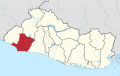
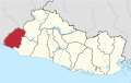 Ahuachapan in El Salvador.svg 983 × 624; 260 KB
-
 Cabanas in El Salvador.svg 983 × 624; 260 KB
-
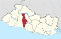
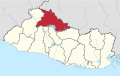 Chalatenango in El Salvador.svg 983 × 624; 260 KB
-
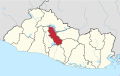 Cuscatlan in El Salvador.svg 983 × 624; 260 KB
-
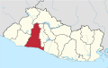 La Libertad in El Salvador.svg 983 × 624; 260 KB
-
 La Paz in El Salvador.svg 983 × 624; 260 KB
-
 La Union in El Salvador.svg 983 × 624; 260 KB
-
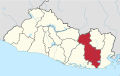
 Morazan in El Salvador.svg 983 × 624; 260 KB
-
 San Miguel in El Salvador.svg 983 × 624; 260 KB
-
 San Salvador in El Salvador.svg 983 × 624; 260 KB
-
 San Vicente in El Salvador.svg 983 × 624; 260 KB
-
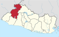 Santa Ana in El Salvador.svg 983 × 624; 260 KB
-
 Sonsonate in El Salvador.svg 983 × 624; 260 KB
-
 Usulutan in El Salvador.svg 983 × 624; 260 KB


