Category:SVG locator maps of ceremonial counties in England (dark sea location map scheme)
Jump to navigation
Jump to search

|
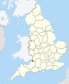
SVG maps in this category are part of a locator map series applying the (de) widespread location map scheme. Please see root category to browse for more. |
.svg)
.svg)
.svg)
.svg)
.svg)
.svg)
.svg)
Locator maps design recommendations ▼ | |
|---|---|
Principles
Design Guidelines are based on ▸location map design of the German map shop (in German). It's preferable to derive new locator maps from existing location maps. Please keep both size and ratio in this case. Thus the new locator maps may still be applied as location map (▸Guide). Marker color is supposed to be darkred. Waterbodies may be transparent, to show other objects better. Please be aware that this guide is only a recommendation. It’s not an inevitable law!
Highlight small areas
“Remote” areas and mini maps
Mini maps show where the depicted area actually is situated. Check out ▸Vorlage:Positionskarte+ (in German) and ▸Modèle:Carte en coin (in French) of how to insert a mini map in virtually every map.
Disputed areas
Greyed special objects
Backgrounds
|

-en.svg)

.svg)
.svg)
.svg)

_(US48).svg)
_(small_islands_magnified)_(-mini_map_-rivers).svg)
.svg)
_(extra_close)_(US48).svg)
.svg)
_(zoom).svg)

.svg)


_(UNMIK).svg)
.svg)
_(disputed_hatched).svg)
_(claimed_and_disputed_hatched).svg)
.svg)
.svg)
_(%2Ball_claims_hatched).svg)

.svg)
_(shade).svg)
_(shade)_(special_marker).svg)
_(-mini_map).svg)
_(-mini_map).svg)
_(-mini_map).svg)


.svg)

.svg)
Media in category "SVG locator maps of ceremonial counties in England (dark sea location map scheme)"
The following 47 files are in this category, out of 47 total.
-
 Bedfordshire UK locator map 2010.svg 1,108 × 1,345; 302 KB
-
 Berkshire UK locator map 2010.svg 1,108 × 1,345; 302 KB
-
 Bristol UK locator map 2010.svg 1,108 × 1,345; 302 KB
-
 Buckinghamshire UK locator map 2010.svg 1,108 × 1,345; 302 KB
-
 Cambridgeshire UK locator map 2010.svg 1,108 × 1,345; 302 KB
-
 Cheshire UK locator map 2010.svg 1,108 × 1,345; 302 KB
-
 Cornwall UK locator map 2010.svg 1,108 × 1,345; 302 KB
-
 County Durham UK locator map 2010.svg 1,108 × 1,345; 302 KB
-
 Cumbria UK locator map 2010.svg 1,108 × 1,345; 302 KB
-
 Derbyshire UK locator map 2010.svg 1,108 × 1,345; 302 KB
-
 Devon UK locator map 2010.svg 1,108 × 1,345; 302 KB
-
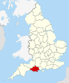 Dorset UK locator map 2010.svg 1,108 × 1,345; 302 KB
-
 East Riding of Yorkshire UK locator map 2010.svg 1,108 × 1,345; 302 KB
-
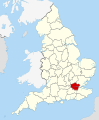
 East Sussex UK locator map 2010.svg 1,108 × 1,345; 302 KB
-
 Essex UK locator map 2010.svg 1,108 × 1,345; 302 KB
-
 Gloucestershire UK locator map 2010.svg 1,108 × 1,345; 302 KB
-
 Greater London UK locator map 2010.svg 1,108 × 1,345; 302 KB
-
 Greater Manchester UK locator map 2010.svg 1,108 × 1,345; 302 KB
-
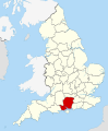 Hampshire UK locator map 2010.svg 1,108 × 1,345; 302 KB
-
 Herefordshire UK locator map 2010.svg 1,108 × 1,345; 302 KB
-
 Hertfordshire UK locator map 2010.svg 1,108 × 1,345; 302 KB
-
 Isle of Wight UK locator map 2010.svg 1,108 × 1,345; 302 KB
-
 Kent UK locator map 2010.svg 1,108 × 1,345; 302 KB
-
 Lancashire UK locator map 2010.svg 1,108 × 1,345; 302 KB
-
 Leicestershire UK locator map 2010.svg 1,108 × 1,345; 302 KB
-
 Lincolnshire UK locator map 2010.svg 1,108 × 1,345; 302 KB
-
 Merseyside UK locator map 2010.svg 1,108 × 1,345; 302 KB
-
 Norfolk UK locator map 2010.svg 1,108 × 1,345; 302 KB
-
 North Yorkshire UK locator map 2010.svg 1,108 × 1,345; 302 KB
-
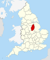
 Northamptonshire UK locator map 2010.svg 1,108 × 1,345; 302 KB
-
 Northumberland UK locator map 2010.svg 1,108 × 1,345; 302 KB
-
 Nottinghamshire UK locator map 2010.svg 1,108 × 1,345; 302 KB
-
 Oxfordshire UK locator map 2010.svg 1,108 × 1,345; 302 KB
-
 Rutland UK locator map 2010.svg 1,108 × 1,345; 302 KB
-
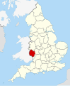
 Shropshire UK locator map 2010.svg 1,108 × 1,345; 302 KB
-
 Somerset UK locator map 2010.svg 1,108 × 1,345; 302 KB
-
 South Yorkshire UK locator map 2010.svg 1,108 × 1,345; 302 KB
-
 Staffordshire UK locator map 2010.svg 1,108 × 1,345; 302 KB
-
 Suffolk UK locator map 2010.svg 1,108 × 1,345; 302 KB
-
 Surrey UK locator map 2010.svg 1,108 × 1,345; 302 KB
-
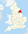
 Tyne and Wear UK locator map 2010.svg 1,108 × 1,345; 302 KB
-
 Warwickshire UK locator map 2010.svg 1,108 × 1,345; 302 KB
-
 West Midlands UK locator map 2010.svg 1,108 × 1,345; 302 KB
-
 West Sussex UK locator map 2010.svg 1,108 × 1,345; 302 KB
-
 West Yorkshire UK locator map 2010.svg 1,108 × 1,345; 302 KB
-
 Wiltshire UK locator map 2010.svg 1,108 × 1,345; 302 KB
-
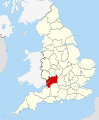
 Worcestershire UK locator map 2010.svg 1,108 × 1,345; 302 KB


