Category:SVG locator maps of Wales
Jump to navigation
Jump to search
Subcategories
This category has only the following subcategory.
Media in category "SVG locator maps of Wales"
The following 62 files are in this category, out of 62 total.
-
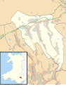 Blaenau Gwent UK location map.svg 990 × 1,266; 407 KB
-
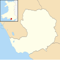
 Blaenau Gwent UK map.svg 990 × 1,266; 227 KB
-
 Bridgend UK location map.svg 1,273 × 1,266; 541 KB
-
 Bridgend UK map.svg 1,273 × 1,266; 267 KB
-
 British Isles United Kingdom WA highlighted.svg 675 × 1,180; 236 KB
-
 British Isles Wales.svg 675 × 1,180; 142 KB
-
 Caerphilly UK community map (BTM).svg 894 × 1,266; 474 KB
-
 Caerphilly UK location map.svg 894 × 1,266; 625 KB
-
 Caerphilly UK map.svg 894 × 1,266; 310 KB
-
 Cardiff UK location map.svg 1,187 × 1,266; 464 KB
-
 Cardiff UK map.svg 1,187 × 1,266; 299 KB
-
 Carmarthenshire UK location map.svg 1,425 × 1,111; 1.29 MB
-
 Carmarthenshire UK map.svg 1,425 × 1,111; 803 KB
-
 Ceredigion UK location map.svg 1,425 × 1,192; 799 KB
-
 Ceredigion UK map.svg 1,425 × 1,192; 526 KB
-
 Clwyd South (Assembly constituency).svg 1,015 × 513; 63 KB
-
 Conwy UK location map.svg 1,425 × 1,275; 731 KB
-
 Conwy UK map.svg 1,425 × 1,275; 490 KB
-
 Denbighshire UK location map.svg 864 × 1,305; 767 KB
-
 Denbighshire UK map.svg 864 × 1,305; 474 KB
-
 Flintshire UK location map.svg 1,177 × 1,305; 758 KB
-
 Flintshire UK map.svg 1,177 × 1,305; 405 KB
-
 Gwynedd UK location map.svg 1,275 × 1,305; 1.12 MB
-
 Gwynedd UK map.svg 1,275 × 1,305; 822 KB
-
 Isle of Anglesey UK location map.svg 1,425 × 1,255; 793 KB
-
 Isle of Anglesey UK map.svg 1,425 × 1,255; 633 KB
-
 LocationWales.svg 1,000 × 500; 2.76 MB
-
 Map of Celtic Nations-flag shades.svg 675 × 1,300; 173 KB
-
 Map of Wales within the United Kingdom.svg 616 × 955; 125 KB
-
 Merthyr Tydfil UK location map.svg 942 × 1,266; 380 KB
-
 Merthyr Tydfil UK map.svg 942 × 1,266; 222 KB
-
 Monmouth location.svg 950 × 1,266; 1,021 KB
-
 Monmouthshire UK location map.svg 950 × 1,266; 1,019 KB
-
 Monmouthshire UK map.svg 950 × 1,266; 594 KB
-
 Neath Port Talbot UK location map.svg 973 × 1,266; 679 KB
-
 Neath Port Talbot UK map.svg 973 × 1,266; 351 KB
-
 Newport UK location map.svg 1,425 × 1,233; 577 KB
-
 Newport UK map roads and areas 2.svg 1,425 × 1,233; 483 KB
-
 Newport UK map roads and areas 3.svg 1,425 × 1,233; 482 KB
-
 Newport UK map roads and areas 3m1.svg 1,425 × 1,233; 482 KB
-
 Newport UK map roads and areas.svg 1,425 × 1,233; 483 KB
-
 Newport UK map.svg 1,425 × 1,233; 404 KB
-
 North Wales (National Assembly for Wales electoral region).svg 1,000 × 1,223; 130 KB
-
 Pembrokeshire UK location map.svg 1,425 × 1,095; 1.06 MB
-
 Pembrokeshire UK map.svg 1,425 × 1,095; 837 KB
-
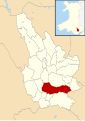
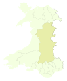
 Powys UK location map.svg 924 × 1,305; 1.75 MB
-
 Powys UK map.svg 924 × 1,305; 785 KB
-
 Rhondda Cynon Taf UK location map.svg 879 × 1,266; 733 KB
-
 Rhondda Cynon Taf UK map.svg 879 × 1,266; 337 KB
-
 Swansea UK location map.svg 1,372 × 1,266; 886 KB
-
 Swansea UK map.svg 1,372 × 1,266; 590 KB
-
 Torfaen UK location map with towns.svg 1,187 × 1,266; 499 KB
-
 Torfaen UK location map.svg 1,187 × 1,266; 496 KB
-
 Torfaen UK map.svg 1,187 × 1,266; 297 KB
-
 Vale of Glamorgan UK location map.svg 1,425 × 895; 583 KB
-
 Vale of Glamorgan UK map.svg 1,425 × 895; 312 KB
-
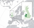 Wales in the UK and Europe.svg 2,045 × 1,720; 7.84 MB
-
 Wales location map subdivisions 1996.svg 512 × 822; 2.67 MB
-
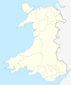 Wales location map.svg 1,047 × 1,252; 237 KB
-
 Wales Powys UA boundary overlay.svg 1,090 × 1,315; 115 KB
-
 Wrexham UK location map.svg 1,425 × 1,008; 631 KB
-
 Wrexham UK map.svg 1,425 × 1,008; 346 KB


.svg)


.svg)


.svg)


