Category:SVG locator maps of Overseas France (location map scheme)
Jump to navigation
Jump to search

|
SVG maps in this category are part of a locator map series applying the (de) widespread location map scheme. Please see root category to browse for more. |
.svg)
.svg)
.svg)
.svg)
.svg)
.svg)
.svg)
Locator maps design recommendations ▼ | |
|---|---|
Principles
Design Guidelines are based on ▸location map design of the German map shop (in German). It's preferable to derive new locator maps from existing location maps. Please keep both size and ratio in this case. Thus the new locator maps may still be applied as location map (▸Guide). Marker color is supposed to be darkred. Waterbodies may be transparent, to show other objects better. Please be aware that this guide is only a recommendation. It’s not an inevitable law!
Highlight small areas
“Remote” areas and mini maps
Mini maps show where the depicted area actually is situated. Check out ▸Vorlage:Positionskarte+ (in German) and ▸Modèle:Carte en coin (in French) of how to insert a mini map in virtually every map.
Disputed areas
Greyed special objects
Backgrounds
|

-en.svg)

.svg)
.svg)
.svg)

_(US48).svg)
_(small_islands_magnified)_(-mini_map_-rivers).svg)
.svg)
_(extra_close)_(US48).svg)
.svg)
_(zoom).svg)

.svg)


_(UNMIK).svg)
.svg)
_(disputed_hatched).svg)
_(claimed_and_disputed_hatched).svg)
.svg)
.svg)
_(%2Ball_claims_hatched).svg)

.svg)
_(shade).svg)
_(shade)_(special_marker).svg)
_(-mini_map).svg)
_(-mini_map).svg)
_(-mini_map).svg)


.svg)

.svg)
Administrative regions and territorial collectivity of Metropolitan France (‡ since start of 2016):
Auvergne-Rhône-Alpes‡ · Bourgogne-Franche-Comté‡ · Bretagne · Centre-Val de Loire · Corsica · Grand Est‡ · Hauts-de-France‡ · Île-de-France · Normandie‡ · Nouvelle-Aquitaine‡ · Occitanie‡ · Pays de la Loire · Provence-Alpes-Côte d'Azur
Former administrative regions of Metropolitan France (until end of 2015):
Alsace · Aquitaine · Auvergne · Bourgogne · Champagne-Ardenne · Franche-Comté · Languedoc-Roussillon · Limousin · Lorraine · Midi-Pyrénées · Nord-Pas-de-Calais · Basse-Normandie · Haute-Normandie · Picardie · Poitou-Charentes · Rhône-Alpes
Overseas departments and regions: Guadeloupe · Martinique · French Guiana · Réunion · Mayotte
Overseas collectivities: Saint-Barthélemy · Saint-Martin (France) · Saint-Pierre and Miquelon · French Polynesia · Wallis and Futuna · the French Southern and Antarctic Lands+ ≈ French Southern and Antarctic Lands+
Sui generis territories: New Caledonia · Clipperton Island+
Subcategories
This category has the following 3 subcategories, out of 3 total.
Media in category "SVG locator maps of Overseas France (location map scheme)"
The following 12 files are in this category, out of 12 total.
-
 France in its region (America special).svg 1,049 × 590; 6.91 MB
-
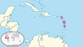 France in its region (Caribbean special).svg 351 × 197; 6.88 MB
-
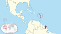 France in its region (Mesoamerica special).svg 735 × 414; 6.93 MB
-
 France in the World (+Antarctica claims) (+EU).svg 2,521 × 1,260; 1.73 MB
-
 France in the World (+Antarctica claims).svg 2,521 × 1,260; 4.22 MB
-
 France in the World (+EU).svg 2,521 × 1,260; 2.34 MB
-
 France in the world (+outlying dependent territories and antarctic claims) (W3).svg 3,188 × 1,948; 5.42 MB
-
 France in the world (+outlying dependent territories) (W3).svg 3,188 × 1,948; 5.42 MB
-
 France in the World.svg 2,521 × 1,260; 4.22 MB
-
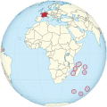 France on the globe (overseas territories special) (Africa centered).svg 797 × 797; 431 KB
-
 Overseas France Icon v2.svg 856 × 436; 733 KB
-
 Overseas France Icon.svg 856 × 436; 738 KB
.svg)
.svg)
.svg)
_(%2BEU).svg)
.svg)
.svg)
_(W3).svg)
_(W3).svg)

_(Africa_centered).svg)