Category:SVG images with embedded raster graphics:Locator maps
Jump to navigation
Jump to search
Media in category "SVG images with embedded raster graphics:Locator maps"
The following 23 files are in this category, out of 23 total.
-
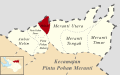 (Peta Lokasi) Desa Halado, Pintu Pohan Meranti, Tobasa.svg 512 × 320; 96 KB
-
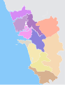
 (Peta Wilayah) Kecamatan Pintu Pohan Meranti, Toba Samosir.svg 512 × 320; 96 KB
-
 Goamap.svg 633 × 820; 159 KB
-
 M25-LTC overlay.svg 314 × 320; 1.27 MB
-
 Mexico location of Baja California Sur.svg 400 × 269; 1,007 KB
-
 Mexico location of Baja California.svg 400 × 269; 997 KB
-
 Mexico location of Campeche.svg 400 × 269; 947 KB
-
 Mexico location of Chiapas.svg 400 × 269; 1.16 MB
-
 Mexico location of Chihuahua.svg 400 × 269; 1.44 MB
-
 Mexico location of Coahuila.svg 400 × 269; 1.03 MB
-
 Mexico location of Colima.svg 400 × 269; 1.01 MB
-
 Mexico location of Michoacan.svg 400 × 269; 1.32 MB
-
 Mexico location of Nayarit.svg 400 × 269; 1.11 MB
-
 Mexico location of Oaxaca.svg 400 × 269; 2.93 MB
-
 Mexico location of Puebla.svg 400 × 269; 1.16 MB
-
 Mexico location of Queretaro.svg 400 × 269; 1.05 MB
-
 Mexico location of San Luis Potosi.svg 400 × 269; 1.43 MB
-
 Mexico location of Sinaloa.svg 400 × 269; 1,015 KB
-
 Mexico location of Tlaxcala.svg 400 × 269; 1.3 MB
-
 Normanskill Watershed, New York (en).svg 1,275 × 901; 1.53 MB
-
 Normanskill Watershed, New York.svg 1,275 × 901; 1.39 MB
-
 Ponce rivers.svg 629 × 760; 318 KB
-
 Pontic steppe region around 650 AD-zh.svg 1,473 × 1,280; 85 KB
_Desa_Halado,_Pintu_Pohan_Meranti,_Tobasa.svg)
_Kecamatan_Pintu_Pohan_Meranti,_Toba_Samosir.svg)


.svg)


