Category:SVG historical location maps of France
Jump to navigation
Jump to search
 |
This category should only contain blank "Location maps" created for geo-location purposes which follow a same uniform standard, and have been created with a Geographic information system (GIS) software program using a compatible equirectangular or conical projection and for which the geographic coordinate system is known. For more information or questions see the wikiproject: German Wikipedia:Kartenwerkstatt/Positionskarten and this discussion page. |
Media in category "SVG historical location maps of France"
The following 47 files are in this category, out of 47 total.
-
 France location map-Regions and departements 1975-2014.svg 2,000 × 1,922; 753 KB
-
 France location map-Regions-2015 (numbered).svg 512 × 492; 457 KB
-
 France location map-Regions-2015.svg 2,000 × 1,922; 519 KB
-
 France South West location map.svg 859 × 838; 268 KB
-
 Alsace region location map.svg 872 × 1,429; 434 KB
-
 Aquitaine region location map.svg 726 × 928; 3.64 MB
-
 France location map-Departements 1790.svg 2,000 × 1,922; 581 KB
-
 France location map-Departements 1791.svg 2,000 × 1,922; 568 KB
-
 France location map-Departements 1793.svg 2,000 × 1,922; 565 KB
-
 France location map-Departements 1795.svg 2,000 × 1,922; 640 KB
-
 France location map-Departements 1797.svg 2,000 × 1,922; 603 KB
-
 France location map-Departements 1798.svg 2,000 × 1,922; 890 KB
-
 France location map-Departements 1800.svg 2,000 × 1,922; 886 KB
-
 France location map-Departements 1801.svg 2,000 × 1,922; 883 KB
-
 France location map-Departements 1802.svg 2,000 × 1,922; 869 KB
-
 France location map-Departements 1805.svg 2,000 × 1,922; 869 KB
-
 France location map-Departements 1808.svg 2,000 × 1,922; 868 KB
-
 France location map-Departements 1810.svg 2,000 × 1,922; 890 KB
-
 France location map-Departements 1811.svg 2,000 × 1,922; 913 KB
-
 France location map-Departements 1812.svg 2,000 × 1,922; 890 KB
-
 France location map-Departements 1813.svg 2,000 × 1,922; 885 KB
-
 France location map-Departements 1814.svg 2,000 × 1,922; 808 KB
-
 France location map-Departements 1815.svg 2,000 × 1,922; 588 KB
-
 France location map-Departements 1848.svg 2,000 × 1,922; 587 KB
-
 France location map-Departements 1852.svg 2,000 × 1,922; 580 KB
-
 France location map-Departements 1860.svg 2,000 × 1,922; 567 KB
-
 France location map-Departements 1871-1914.svg 2,000 × 1,922; 599 KB
-
 France location map-Departements 1919.svg 2,000 × 1,922; 575 KB
-
 France location map-Departements 1947.svg 2,000 × 1,922; 573 KB
-
 France location map-Departements 1964.svg 2,000 × 1,922; 577 KB
-
 France location map-Departements 1967.svg 2,000 × 1,922; 598 KB
-
 France location map-Departements 1970.svg 2,000 × 1,922; 578 KB
-
 France location map-Departements 1971-1972.svg 2,000 × 1,922; 620 KB
-
 France location map-Departements 1973-1974.svg 2,000 × 1,922; 673 KB
-
 France location map-Departements 1975-1996.svg 2,000 × 1,922; 675 KB
-
 France location map-Departements 1997-2014.svg 2,000 × 1,922; 783 KB
-
 France location map-Provinces 1789.svg 2,000 × 1,922; 557 KB
-
 France location map-Regions and departements-2015.svg 2,000 × 1,922; 699 KB
-
 Languedoc-Roussillon region location map.svg 472 × 500; 610 KB
-
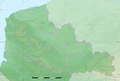 Nord, Pas-de-Calais & Somme relief location map.png 1,576 × 1,069; 2 MB
-
 Nord-Pas-de-Calais region location map.svg 1,576 × 1,069; 515 KB
-
 Nord-Pas-de-Calais region relief location map.jpg 1,576 × 1,069; 339 KB
-
 Basse-Normandie region location map.svg 1,414 × 1,146; 591 KB
-
 Haute-Normandie region location map.svg 969 × 1,250; 377 KB
-
 Picardie region location map.svg 1,842 × 1,391; 446 KB
-
 Poitou-Charentes region location map.svg 1,136 × 1,265; 538 KB
-
 Rhône-Alpes region location map.svg 1,275 × 1,275; 3.42 MB

.svg)


