Category:SVG flag maps of Croatia
Jump to navigation
Jump to search
Media in category "SVG flag maps of Croatia"
The following 19 files are in this category, out of 19 total.
-
 Croatia EU.svg 732 × 734; 72 KB
-
 Croatia-Flagmap.svg 838 × 826; 2.09 MB
-
 Flag map of Croatia (1947–1990).svg 733 × 734; 74 KB
-
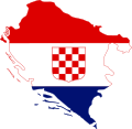
 Flag map of Croatia.svg 613 × 599; 284 KB
-
 Flag map of Istria (Peninsula).svg 612 × 884; 271 KB
-
 Flag map of Istria County.svg 700 × 1,000; 61 KB
-
 Flag map of the Austrian Empire (1816-1869).svg 793 × 593; 27 KB
-
 Flag map of the Italian governate of Dalmatia (1941-1943).svg 2,265 × 1,894; 260 KB
-
 Flag map of the Kingdom of Dalmatia.svg 704 × 601; 32 KB
-
 Flag map of the Province of Zara.svg 822 × 845; 223 KB
-
 Flag map of the Republic of Venice (697–1797).svg 2,409 × 1,567; 204 KB
-
 Flag-map of Croatia-Slavonia.svg 296 × 163; 2.01 MB
-
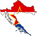
 Flag-map of Greater Croatia.svg 953 × 783; 347 KB
-
 Flag-map of Independent State of Croatia (1941-1944).svg 2,031 × 1,979; 38 KB
-
 Flag-map of the State of Slovenes, Croats and Serbs.svg 471 × 477; 56 KB
-
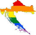 LGBT flag map of Croatia.svg 491 × 480; 118 KB
-
 Silhouette of Croatia.svg 900 × 877; 69 KB
-
 Silhouette of the Independent State of Croatia.svg 900 × 869; 55 KB
-
 Silhouette of the Socialist Republic of Croatia.svg 900 × 877; 72 KB


.svg)

.svg)

.svg)
.svg)


.svg)


.svg)


