Category:SVG created with QGIS and Adobe Illustrator
Jump to navigation
Jump to search
Media in category "SVG created with QGIS and Adobe Illustrator"
The following 20 files are in this category, out of 20 total.
-
 2010unitedstatespopulationdensity.svg 3,503 × 1,788; 2.67 MB
-
 2023 Titan submersible incident map.svg 512 × 512; 667 KB
-
 Bancroft uranium mining map.svg 739 × 545; 3.35 MB
-
 Germany (+districts +municipalities) location map 2013.svg 1,779 × 2,095; 25.26 MB
-
 Germany (+districts +municipalities) location map current.svg 1,779 × 2,095; 25.26 MB
-
 Iran Air Flight 655 map.svg 458 × 595; 161 KB
-
 JRLinesMatsushima.svg 512 × 384; 319 KB
-
 JRSensekiLineSince2015.svg 512 × 362; 491 KB
-
 Kurdish-inhabited areas (orthographic projection with inset).svg 512 × 512; 852 KB
-
 Kymijoki topographic map.svg 512 × 688; 6.66 MB
-
 Major water transfer schemes in England and Wales map.svg 334 × 432; 655 KB
-
 Monodon monoceros distribution map.svg 567 × 567; 633 KB
-
 Oklahoma Tribal Statistical Area.svg 828 × 400; 1.49 MB
-
 Polar bear subpopulation map.svg 655 × 648; 717 KB
-
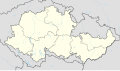 Protectorate of Bohemia and Moravia adm location map.svg 653 × 383; 175 KB
-
 RailwayRouteMapInSendaiCity.svg 512 × 617; 1.42 MB
-
 SendaiSubwayRouteMap.svg 512 × 512; 638 KB
-
 Welsh speakers in the 2021 census.svg 512 × 561; 427 KB
-
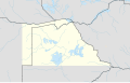 Zambesia location map.svg 524 × 333; 787 KB
-
 岡谷・辰野・塩尻付近 JR路線図.svg 512 × 362; 840 KB


_location_map_2013.svg)
_location_map_current.svg)


.svg)


