Category:SVG administrative maps of regions of France
Jump to navigation
Jump to search
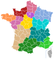
Administrative regions and territorial collectivity of Metropolitan France (‡ since start of 2016):
Centre-Val de Loire
Centre-Val de Loire
- Please use Category:SVG locator maps of regions in France (bright red location map scheme) (current standard) to illustrate your articles.
Subcategories
This category has the following 3 subcategories, out of 3 total.
Media in category "SVG administrative maps of regions of France"
The following 14 files are in this category, out of 14 total.
-
 Régions de France 2016.svg 1,000 × 960; 485 KB
-
 Carte Agence francaise pour la biodiversite.svg 2,000 × 1,922; 2.9 MB
-
 Carte des régions en 2016.svg 507 × 553; 90 KB
-
 Collectivités territoriales uniques 2018.svg 429 × 518; 74 KB
-
 Collectivités territoriales uniques France.svg 512 × 551; 114 KB
-
 Cridon.svg 530 × 550; 494 KB
-
 CTU France 2021.svg 429 × 518; 78 KB
-
 Départements et régions de France - Noname-2016.svg 588 × 550; 405 KB
-
 Départements+régions (France)-2016.svg 677 × 618; 431 KB
-
 France (Régions).svg 1,000 × 960; 16.39 MB
-
 France location map – regions and departments (including overseas).svg 2,000 × 1,922; 1,005 KB
-
 Regions France 2016.svg 575 × 575; 76 KB
-
 Régions de France 2016 avec outremer.svg 1,001 × 1,057; 831 KB
-
 Régions de France 2016 PL.svg 607 × 585; 406 KB


-2016.svg)
.svg)
.svg)


