Category:SKH Yat Sau Primary School
Jump to navigation
Jump to search
| Object location | | View all coordinates using: OpenStreetMap |
|---|
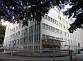
former primary school in Hong Kong  | |||||
| Upload media | |||||
| Instance of | |||||
|---|---|---|---|---|---|
| Location | Hong Kong, PRC | ||||
| Street address |
| ||||
| Dissolved, abolished or demolished date |
| ||||
| Replaced by | |||||
 | |||||
中文:聖公會日修小學
Media in category "SKH Yat Sau Primary School"
The following 3 files are in this category, out of 3 total.
-
 Former S.K.H. Yat Sau Primary School.jpg 6,000 × 4,000; 11.32 MB
-
 S.K.H. Yat Sau Primary School (full view).jpg 3,541 × 2,600; 6.54 MB
-
 S.K.H. Yat Sau Primary School.JPG 3,648 × 2,736; 1.98 MB
.jpg)
