Category:Sülm
Jump to navigation
Jump to search
municipality of Germany    | |||||
| Upload media | |||||
| Instance of |
| ||||
|---|---|---|---|---|---|
| Location | Eifelkreis Bitburg-Prüm, Rhineland-Palatinate, Germany | ||||
| Population |
| ||||
| Area |
| ||||
| Elevation above sea level |
| ||||
| Different from | |||||
| official website | |||||
 | |||||
Subcategories
This category has the following 2 subcategories, out of 2 total.
!
S
- St. Petrus (Sülm) (11 F)
Media in category "Sülm"
The following 7 files are in this category, out of 7 total.
-
 DEU Sülm COA.svg 677 × 741; 21 KB
-
 Wappen Suelm.png 238 × 257; 22 KB
-
 Blick auf Sülm.jpg 2,816 × 1,584; 2.1 MB
-
 Pfarrkirche Sülm - Inschrift, links vom Eingang.JPG 2,816 × 2,112; 2.43 MB
-
 Pfarrkirche Sülm - Treppe aus dem Dorf.JPG 2,816 × 2,112; 3.51 MB
-

-
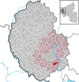 Sülm in BIT.svg 354 × 369; 268 KB


.jpg)