Category:Ryhope, Sunderland
Jump to navigation
Jump to search
village along the southern boundary of the City of Sunderland, in Tyne and Wear, North East England  | |||||
| Upload media | |||||
| Instance of | |||||
|---|---|---|---|---|---|
| Location | Sunderland, Tyne and Wear, North East England, England | ||||
| Population |
| ||||
 | |||||
Subcategories
This category has the following 4 subcategories, out of 4 total.
P
- Ryhope Pumping Station (5 F)
R
- Ryehope (7 F)
- Ryhope railway station (2 F)
- Ryhope War Memorial (1 F)
Media in category "Ryhope, Sunderland"
The following 10 files are in this category, out of 10 total.
-
 Beach and cliffs near Ryhope - geograph.org.uk - 5518789.jpg 800 × 600; 97 KB
-

-
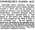 Councillor's Plucky Act - Manchester Guardian - 1930-03-21 - page 10.png 533 × 459; 224 KB
-
 Pincushion Rocks - geograph.org.uk - 494829.jpg 640 × 480; 95 KB
-
 Pincushion Rocks - geograph.org.uk - 5090652.jpg 1,000 × 563; 182 KB
-
 Railway Inn, Ryhope - geograph.org.uk - 5073875.jpg 800 × 533; 163 KB
-
 Road in dene east of Ryehope - geograph.org.uk - 1530812.jpg 640 × 480; 131 KB
-
 Ryhope Road, Sunderland - geograph.org.uk - 404660.jpg 640 × 467; 60 KB
-
 Tunstall old fire station - geograph.org.uk - 1393277.jpg 640 × 427; 204 KB
-
 Pincushion, Ryhope - geograph.org.uk - 404668.jpg 476 × 640; 81 KB


