Category:Ruxley, London
Jump to navigation
Jump to search
area in South-East London, on the boundary between Bexley and Bromley  | |||||
| Upload media | |||||
| Instance of | |||||
|---|---|---|---|---|---|
| Location |
| ||||
 | |||||
Subcategories
This category has the following 4 subcategories, out of 4 total.
O
- Oasts in Ruxley (2 F)
R
- St Botolph's Church, Ruxley (17 F)
- Ruxley Farmhouse (2 F)
- Ruxley Gravel Pits (1 F)
Media in category "Ruxley, London"
The following 12 files are in this category, out of 12 total.
-
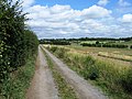 Farm access track - geograph.org.uk - 3601955.jpg 640 × 480; 100 KB
-
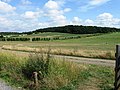
 Field beside Cookham Lane - geograph.org.uk - 3606948.jpg 640 × 427; 96 KB
-
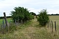
 Fields - geograph.org.uk - 3601960.jpg 640 × 480; 92 KB
-
-
 Klinger Building, Ruxley (01).jpg 4,256 × 3,274; 10.47 MB
-
 Klinger Building, Ruxley (02).jpg 4,471 × 3,211; 11.85 MB
-
 Klinger Building, Ruxley (03).jpg 4,592 × 3,448; 13.38 MB
-
 Klinger Building, Ruxley (04).jpg 3,448 × 4,592; 13.8 MB
-
 Klinger Building, Ruxley (05).jpg 3,448 × 4,592; 14.68 MB
-
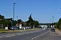 Maidstone Road - geograph.org.uk - 3581026.jpg 640 × 427; 53 KB
-
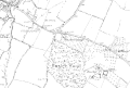 Ruxley-1840.GIF 700 × 471; 16 KB
-
 View across Cray Valley Golf Course - geograph.org.uk - 3606949.jpg 640 × 427; 85 KB


.jpg)
.jpg)
.jpg)
.jpg)
.jpg)


