Category:Rusthoek
Jump to navigation
Jump to search
| Object location | | View all coordinates using: OpenStreetMap |
|---|
 | |||||
| Upload media | |||||
| Instance of | |||||
|---|---|---|---|---|---|
| Part of | |||||
| Location | Baarn, Utrecht, Netherlands | ||||
| Street address |
| ||||
| Located on street |
| ||||
| Heritage designation |
| ||||
 | |||||
|
This is a category about rijksmonumentcomplex number 511674
|
Villa:
|
This is a category about rijksmonument number 511675
|
Koetshuis:
|
This is a category about rijksmonument number 511676
|
Parkaanleg:
|
This is a category about rijksmonument number 511677
|
Zonnewijzer:
|
This is a category about rijksmonument number 511678
|
Hekpijlers:
|
This is a category about rijksmonument number 511679
|
Hekpijlers:
|
This is a category about rijksmonument number 511680
|
| Address |
|
Media in category "Rusthoek"
The following 19 files are in this category, out of 19 total.
-
 1954 EF Vormingscentrum KVP.jpg 2,008 × 1,269; 673 KB
-
 Baarn EF Gemeentehuis Laanstr 1 Rm 511746.jpg 2,288 × 1,712; 1.38 MB
-
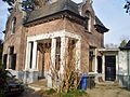
 Baarn EF Koetshuis Rusthoek RM 511676 Bijgebouwen.jpg 2,288 × 1,712; 774 KB
-
 Baarn EF Rusthoek RM 511677 Tuin en park.jpg 2,288 × 1,712; 1.26 MB
-
 Baarn EF Rusthoek RM 511678 Tuin en park.jpg 2,218 × 1,633; 519 KB
-
 Baarn EF Rusthoek Tuin en Park RM 511677.jpg 2,288 × 1,712; 1.23 MB
-
 Baarn EF Rusthoek Tuin en Park RM 511678.jpg 2,288 × 1,712; 839 KB
-
 Baarn koetshuis villa Rusthoek 2013 63.JPG 3,154 × 2,294; 2.31 MB
-
 Baarn portierswoning Rusthoek 506.jpg 3,264 × 2,448; 2.71 MB
-
 Baarn Portierswoning Rusthoek 92.JPG 3,264 × 2,448; 3.33 MB
-
 Baarn Portierswoning Rusthoek 93.JPG 3,264 × 2,448; 3.14 MB
-
 Baarn Rusthoek48.JPG 3,264 × 2,448; 3.8 MB
-
 Baarn, Rusthoek hekpijlers 1771-1800 RM511679.jpg 5,431 × 3,600; 6.09 MB
-
 Baarn, Rusthoek oostelijk inrijhek RM511680.jpg 3,602 × 2,010; 6.34 MB
-
 Baarn, Rusthoek pijlers oostelijk inrijhek 1905 RM511680.jpg 5,040 × 3,540; 5.68 MB
-

-

-

-
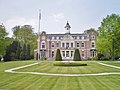
 Rusthoek (J.F. Kennedylaan, Baarn).jpg 1,280 × 853; 433 KB


.jpg)