Category:Rushwick
Jump to navigation
Jump to search
village in Worcestershire, England, UK  | |||||
| Upload media | |||||
| Instance of | |||||
|---|---|---|---|---|---|
| Location | Malvern Hills, Worcestershire, West Midlands, England | ||||
 | |||||
Media in category "Rushwick"
The following 90 files are in this category, out of 90 total.
-
 A4103 from Claphill Lane, 1 - geograph.org.uk - 5670742.jpg 1,600 × 901; 712 KB
-
 A4103 from Claphill Lane, 2 - geograph.org.uk - 5670744.jpg 1,600 × 901; 661 KB
-
 A4103 heading towards Worcester - geograph.org.uk - 4374690.jpg 1,600 × 1,058; 409 KB
-
 Bransford Bridge - geograph.org.uk - 2341113.jpg 640 × 427; 83 KB
-
 Bransford Road, Rushwick - geograph.org.uk - 2453407.jpg 1,024 × 673; 222 KB
-
 Broadway Grove, Worcester - geograph.org.uk - 840625.jpg 640 × 458; 78 KB
-
 Bus shelter, Bransford Road, Rushwick - geograph.org.uk - 2434735.jpg 1,024 × 667; 193 KB
-
 Bus stop in Rushwick - geograph.org.uk - 2327664.jpg 640 × 427; 115 KB
-
 Claphill Lane, Rushwick - geograph.org.uk - 2836037.jpg 1,024 × 680; 212 KB
-

-
 Crop field at Rushwick - geograph.org.uk - 4164077.jpg 1,024 × 683; 271 KB
-
-
 Field next to bypass - geograph.org.uk - 2138752.jpg 640 × 480; 84 KB
-
 Field with sheep, Upper Wick, Rushwick, Worcs - geograph.org.uk - 5094509.jpg 1,024 × 683; 164 KB
-
 Fields near the River Teme - geograph.org.uk - 2138846.jpg 640 × 480; 93 KB
-
 Footbridge over Hams Way - geograph.org.uk - 4165276.jpg 3,503 × 2,012; 2.84 MB
-
 Former Kays site, St John's - geograph.org.uk - 2836011.jpg 1,024 × 680; 178 KB
-
 Former Rushwick CofE Primary School - geograph.org.uk - 1869784.jpg 640 × 480; 90 KB
-
 Former Rushwick CofE Primary School - geograph.org.uk - 1869786.jpg 640 × 480; 114 KB
-

-
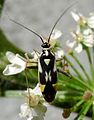 Grypocoris stysi. Miridae - Flickr - gailhampshire (1).jpg 1,103 × 1,409; 195 KB
-
 Grypocoris stysi. Miridae - Flickr - gailhampshire.jpg 833 × 822; 163 KB
-
 Huge ploughed field - geograph.org.uk - 841923.jpg 640 × 480; 64 KB
-
 If it ain't sunny it will be windy - geograph.org.uk - 2341174.jpg 427 × 640; 48 KB
-
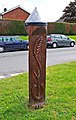
 Jubilee Milestone (1), Bransford Road, Rushwick - geograph.org.uk - 2453430.jpg 687 × 1,024; 252 KB
-
 Jubilee Milestone (2), Bransford Road, Rushwick - geograph.org.uk - 2453435.jpg 646 × 1,024; 236 KB
-
 Jubilee Milestone (3), Bransford Road, Rushwick - geograph.org.uk - 2453447.jpg 720 × 1,024; 259 KB
-
 Jubilee Milestone, Rushwick - geograph.org.uk - 523455.jpg 640 × 427; 250 KB
-
 Large layby on the A4103 - geograph.org.uk - 4165319.jpg 4,185 × 2,105; 3.21 MB
-
 Layby along the A4103 - geograph.org.uk - 4374701.jpg 1,600 × 1,072; 493 KB
-
 Looking toward Malvern from Crown East - geograph.org.uk - 6011983.jpg 1,600 × 1,200; 255 KB
-
 Looking towards Malvern from Crown East (2) - geograph.org.uk - 6011987.jpg 1,600 × 1,200; 284 KB
-
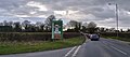
 Milepost in Rushwick - geograph.org.uk - 2326345.jpg 640 × 427; 91 KB
-
 New roads for old - geograph.org.uk - 841873.jpg 640 × 480; 100 KB
-
-
 Oast House - geograph.org.uk - 4164072.jpg 1,024 × 683; 205 KB
-
 On Grove Way approaching the roundabout - geograph.org.uk - 4165306.jpg 3,544 × 1,905; 2.85 MB
-
 Otherton Farm - geograph.org.uk - 77275.jpg 640 × 479; 127 KB
-
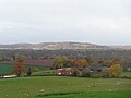 Otherton Farm with the Suckley Hills in the sun - geograph.org.uk - 6011984.jpg 1,600 × 1,200; 223 KB
-
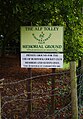
 Parish notice board, Bransford Road, Rushwick - geograph.org.uk - 2434762.jpg 1,024 × 673; 257 KB
-
 Pollarded oak in Crown East Lane - geograph.org.uk - 4030608.jpg 1,024 × 683; 364 KB
-

-
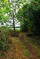 Public footpath at Upper Wick, Rushwick, Worcs - geograph.org.uk - 5094540.jpg 696 × 1,024; 304 KB
-

-

-
 Railway at Rushwick - geograph.org.uk - 2452729.jpg 1,024 × 683; 237 KB
-
 Railway line at Rushwick - geograph.org.uk - 3796655.jpg 4,320 × 3,240; 3.02 MB
-
 Road bridge over Bransford Road, Rushwick - geograph.org.uk - 2452744.jpg 1,024 × 667; 257 KB
-
 Road in Upper Wick on a sunny day - geograph.org.uk - 2138854.jpg 640 × 480; 111 KB
-
 Road to Rushwick - geograph.org.uk - 2138857.jpg 640 × 480; 94 KB
-
 Roadworks at Crown East - geograph.org.uk - 6407099.jpg 3,635 × 1,604; 1.52 MB
-
 Roundabout on Grove Way, Crown East - geograph.org.uk - 6152534.jpg 1,920 × 1,280; 989 KB
-
 Roundabout on Hams Way, Upper Wick - geograph.org.uk - 6152533.jpg 1,892 × 1,236; 1.16 MB
-
 Roundabout on the A44, Crown East - geograph.org.uk - 6167182.jpg 1,895 × 1,262; 1.2 MB
-
 Rushwick - former major junction - geograph.org.uk - 841882.jpg 640 × 480; 61 KB
-

-
 Rushwick - site of the railway halt - geograph.org.uk - 841878.jpg 480 × 640; 106 KB
-
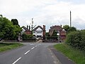
 Rushwick - The Whitehall Inn - geograph.org.uk - 841863.jpg 640 × 480; 74 KB
-
 Rushwick - Whitehall Close - geograph.org.uk - 841860.jpg 640 × 480; 73 KB
-
 Rushwick bypass - geograph.org.uk - 841892.jpg 640 × 480; 86 KB
-

-
 Rushwick School - geograph.org.uk - 3796653.jpg 4,320 × 3,240; 2.89 MB
-
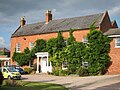
 Rushwick Village Hall - geograph.org.uk - 2836028.jpg 1,024 × 680; 220 KB
-
 Rushwick Village Hall - geograph.org.uk - 53888.jpg 640 × 426; 133 KB
-
 Rushwick Village Hall, Bransford Road, Rushwick - geograph.org.uk - 2434712.jpg 1,024 × 667; 198 KB
-
 Rushwick, Worcestershire, 1 - geograph.org.uk - 5676048.jpg 1,600 × 901; 841 KB
-
 Rushwick, Worcestershire, 2 - geograph.org.uk - 5676051.jpg 1,600 × 901; 845 KB
-
 St Thomas Church, Crown East - geograph.org.uk - 6152535.jpg 1,920 × 1,280; 936 KB
-
 Stanfield House,Upper Wick Lane, Rushwick - geograph.org.uk - 4164076.jpg 1,024 × 768; 253 KB
-
 Stanfield Nursing Home, Upper Wick - geograph.org.uk - 3796646.jpg 4,320 × 3,240; 2.91 MB
-
 Teme flood culverts - geograph.org.uk - 841931.jpg 640 × 480; 71 KB
-
 The A4103 at the turn-off to Rushwick - geograph.org.uk - 3796659.jpg 4,320 × 3,240; 2.98 MB
-
 The Malvern Hills from Crown East - geograph.org.uk - 4306886.jpg 640 × 480; 36 KB
-
 The new Bransford Road - geograph.org.uk - 1826670.jpg 640 × 480; 251 KB
-
 The old Bransford Road - geograph.org.uk - 1826662.jpg 640 × 480; 256 KB
-
 Trees and ponds, Crown East, Worcestershire - geograph.org.uk - 6011979.jpg 1,600 × 1,200; 357 KB
-
 Upper Wick farm - geograph.org.uk - 841853.jpg 640 × 480; 71 KB
-
 Upper Wick Lane, Rushwick - geograph.org.uk - 2452689.jpg 1,024 × 670; 194 KB
-
 Upper Wick Lane, Upper Wick, Rushwick, Worcs - geograph.org.uk - 5094406.jpg 1,024 × 683; 274 KB
-
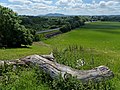 View across the Teme Valley - geograph.org.uk - 4374713.jpg 1,600 × 1,200; 746 KB
-

-
 Wet walkers near Crown East - geograph.org.uk - 5997256.jpg 1,600 × 1,200; 332 KB
-
 Whitehall Inn (1), Bransford Road, Rushwick - geograph.org.uk - 2452643.jpg 1,024 × 655; 254 KB
-

-
 Whitehall Inn (3), Bransford Road, Rushwick - geograph.org.uk - 2452667.jpg 1,024 × 658; 240 KB
-
 Whitehall Inn, Rushwick - geograph.org.uk - 2836018.jpg 1,024 × 680; 202 KB
-
 Whitehall Inn, Rushwick - geograph.org.uk - 3796656.jpg 4,320 × 3,240; 2.94 MB
-
 Worcester's bypass starts here - geograph.org.uk - 841907.jpg 640 × 480; 87 KB
-
 Rushwick Halt (Site Of) - geograph.org.uk - 523462.jpg 640 × 407; 247 KB
-
 The Whitehall Inn, Rushwick - geograph.org.uk - 53887.jpg 640 × 426; 106 KB


.jpg)


,_Bransford_Road,_Rushwick_-_geograph.org.uk_-_2453430.jpg)
,_Bransford_Road,_Rushwick_-_geograph.org.uk_-_2453435.jpg)
,_Bransford_Road,_Rushwick_-_geograph.org.uk_-_2453447.jpg)


_-_geograph.org.uk_-_6011987.jpg)


,_Bransford_Road,_Rushwick_-_geograph.org.uk_-_2452643.jpg)
_-_sign,_Bransford_Road,_Rushwick_-_geograph.org.uk_-_2452649.jpg)
,_Bransford_Road,_Rushwick_-_geograph.org.uk_-_2452667.jpg)


_-_geograph.org.uk_-_523462.jpg)
