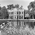
Category:Rupelmonde, Nieuwersluis
Jump to navigation
Jump to search
| Object location | | View all coordinates using: OpenStreetMap |
|---|
Dutch country estate | |||||
| Upload media | |||||
| Instance of | |||||
|---|---|---|---|---|---|
| Location | Nieuwersluis, Stichtse Vecht, Utrecht, Netherlands | ||||
| Has part(s) | |||||
| Heritage designation |
| ||||
 | |||||
|
This is a category about rijksmonumentcomplex number 508190
|
Landhuis:
|
This is a category about rijksmonument number 508189
|
Historische aanleg:
|
This is a category about rijksmonument number 508191
|
Toegangshek:
|
This is a category about rijksmonument number 508192
|
Tuinbeelden:
|
This is a category about rijksmonument number 508193
|
Koetshuis:
|
This is a category about rijksmonument number 508194
|
Aanleghek:
|
This is a category about rijksmonument number 508195
|
Speelhuisje:
|
This is a category about rijksmonument number 508196
|
Tuinmuur:
|
This is a category about rijksmonument number 508197
|
Tuinhuis:
|
This is a category about rijksmonument number 508198
|
| Address |
|
Media in category "Rupelmonde, Nieuwersluis"
The following 31 files are in this category, out of 31 total.
-
19th century estates along the Vecht river - panoramio.jpg 4,288 × 2,848; 2.97 MB
-
3631 Nieuwersluis, Netherlands - panoramio (2).jpg 2,048 × 1,148; 554 KB
-
508189-Huis Rupelmonde.jpg 4,520 × 3,013; 10.22 MB
-
Achtergevel - Nieuwersluis - 20164737 - RCE.jpg 1,200 × 1,197; 410 KB
-
Achtergevel - Nieuwersluis - 20164738 - RCE.jpg 1,200 × 1,197; 401 KB
-
Achtergevel - Nieuwersluis - 20164739 - RCE.jpg 1,195 × 1,200; 471 KB
-
Diensthuis - Nieuwersluis - 20164741 - RCE.jpg 1,200 × 810; 277 KB
-
HUA-201867-Gezicht over de Vecht op het huis Rupelmonde bij Nieuwersluis.jpg 1,455 × 815; 370 KB
-
Langs de Vecht - panoramio (13).jpg 3,188 × 4,815; 17.49 MB
-
Nieuwersluis - Rupelmonde koetshuis RM508194.JPG 4,010 × 2,825; 1.4 MB
-
Nieuwersluis - Rupelmonde RM508189.JPG 3,710 × 2,745; 1.49 MB
-
Nieuwersluis - Rupelmonde toegangshek RM508192.JPG 4,191 × 3,249; 1.4 MB
-
Nieuwersluis - Rupelmonde tuinmuur RM508197.JPG 4,608 × 2,845; 1.79 MB
-
Nieuwersluis Huis Rupelmonde.JPG 2,560 × 1,920; 1.54 MB
-
Nieuwersluis Rijksstraatweg 24.JPG 3,264 × 2,448; 2.39 MB
-
Nieuwersluis Rijksstraatweg bij 24.JPG 2,448 × 3,264; 2.18 MB
-
Nieuwersluis, Vecht - panoramio (1).jpg 4,246 × 2,269; 2.41 MB
-
Nieuwersluis, Vecht - panoramio.jpg 4,273 × 1,788; 2.03 MB
-
Overzicht achtergevel - Nieuwersluis - 20164736 - RCE.jpg 1,195 × 1,200; 425 KB
-
Overzicht met voorgevel - Nieuwersluis - 20164733 - RCE.jpg 1,200 × 941; 375 KB
-
Overzicht met voorgevel - Nieuwersluis - 20164734 - RCE.jpg 1,200 × 943; 376 KB
-
Rupelmonde.jpg 791 × 594; 197 KB
-
Steendruk- Lutgers - Nieuwersluis - 20164740 - RCE.jpg 1,200 × 947; 289 KB
-
Voorgevel - Nieuwersluis - 20164735 - RCE.jpg 1,193 × 1,200; 397 KB


