Category:Ruins on Islay
Jump to navigation
Jump to search
Subcategories
This category has the following 9 subcategories, out of 9 total.
D
- Dunyvaig Castle (14 F)
F
- Ruined house, Finlaggan (14 F)
K
- Kilchiaran Chapel (7 F)
- Kilfinlaggan Chapel (15 F)
T
- The Oa Church, Risabus (2 F)
Media in category "Ruins on Islay"
The following 32 files are in this category, out of 32 total.
-
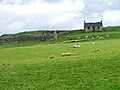
 Abandoned Farm House at Loch gorm - geograph.org.uk - 261911.jpg 640 × 480; 100 KB
-
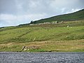
 Achadh - geograph.org.uk - 760125.jpg 640 × 480; 67 KB
-
 Ardnahoe - geograph.org.uk - 762143.jpg 640 × 480; 64 KB
-
 Buaile Mhic-lante - geograph.org.uk - 15847.jpg 640 × 480; 107 KB
-
 Croft by Finlaggan - geograph.org.uk - 1150543.jpg 640 × 427; 56 KB
-
 Desolate deserted dwelling - geograph.org.uk - 597554.jpg 640 × 426; 57 KB
-
 Gortantaoid, Islay - geograph.org.uk - 341112.jpg 640 × 479; 136 KB
-
 Gortantoid Farm - geograph.org.uk - 1740489.jpg 640 × 426; 81 KB
-
 Gortantoid Farm, Islay - geograph.org.uk - 1740493.jpg 640 × 426; 65 KB
-
 Gortantoid from east - geograph.org.uk - 1740486.jpg 640 × 427; 70 KB
-
 Ineraval, Islay - geograph.org.uk - 1757862.jpg 640 × 426; 61 KB
-
 Kintour Chapel, Islay - geograph.org.uk - 1749173.jpg 1,600 × 1,067; 381 KB
-
 Kintour Chapel, Islay - geograph.org.uk - 1749177.jpg 1,600 × 1,067; 455 KB
-
 Lurabus, deserted settlement, Islay - geograph.org.uk - 1470539.jpg 640 × 480; 81 KB
-
 Old engine house at Mulreesh - geograph.org.uk - 753902.jpg 640 × 480; 60 KB
-
 Old Laggan Bridge - geograph.org.uk - 134696.jpg 640 × 480; 192 KB
-
 Remains of a barn at Sanaigmore - geograph.org.uk - 756082.jpg 640 × 336; 39 KB
-
 Ruin near Mulreesh - geograph.org.uk - 1150564.jpg 640 × 427; 50 KB
-
 Sean-Ghairt - geograph.org.uk - 15842.jpg 640 × 480; 104 KB
-
 Skeleton on the beach - geograph.org.uk - 758742.jpg 640 × 356; 23 KB
-
 Wartime Lookout Point - geograph.org.uk - 700315.jpg 640 × 434; 56 KB
-
 Within WW2 Bunker - geograph.org.uk - 656314.jpg 640 × 428; 78 KB
-

-
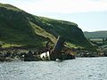 Wreck at Ruabh a Mhill - geograph.org.uk - 210215.jpg 640 × 480; 72 KB
-
 Derelict cottage at Gartantaoid - geograph.org.uk - 753873.jpg 640 × 339; 55 KB
-
 Disused Lime Kiln - geograph.org.uk - 15586.jpg 640 × 480; 123 KB
-
 Frachdale - geograph.org.uk - 1415057.jpg 640 × 427; 340 KB
-
 Frachdale - geograph.org.uk - 15786.jpg 640 × 480; 130 KB
-
 Gortantaoid, Islay - geograph.org.uk - 341133.jpg 640 × 479; 195 KB
-
 Killinallan farmhouse - geograph.org.uk - 759148.jpg 640 × 412; 55 KB
-
 Ruin at Balimony - geograph.org.uk - 112425.jpg 640 × 480; 222 KB
-
 Watermill, Lower Glen Astle, Islay - geograph.org.uk - 271908.jpg 640 × 480; 97 KB


