Category:Ruins of barns
Jump to navigation
Jump to search
Subcategories
This category has the following 2 subcategories, out of 2 total.
B
- Untergasse 47 (Biedenkopf) (3 F)
K
- Kinney Octagon Barn (3 F)
Media in category "Ruins of barns"
The following 55 files are in this category, out of 55 total.
-
 20110829-FSA-XX-0032 - Flickr - USDAgov.jpg 2,288 × 1,712; 639 KB
-

-
 A roofless barn in a hay meadow - geograph.org.uk - 503152.jpg 640 × 480; 80 KB
-
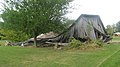
 A Ruined Barn - geograph.org.uk - 260220.jpg 640 × 480; 73 KB
-

-
 Ankershagen-Alte-Muellerscheune.jpg 4,000 × 3,000; 3.07 MB
-
 Auciems manor barn ruins - panoramio.jpg 800 × 600; 266 KB
-
 Barn - geograph.org.uk - 251286.jpg 640 × 480; 85 KB
-
 Barn - geograph.org.uk - 259517.jpg 640 × 479; 98 KB
-
 Barn in Covington Township.jpg 2,816 × 2,112; 1.47 MB
-
 Barn near Men-an-Tol.jpg 3,576 × 2,324; 4.73 MB
-
 Barns at Hyssington - geograph.org.uk - 1108843.jpg 640 × 480; 81 KB
-
 Collapsed barn at Lancaster.jpg 2,816 × 1,584; 2.44 MB
-
 Cycle Oregon 2012 (7996062283).jpg 3,072 × 2,304; 1.45 MB
-
 Derelict Barn (8234395538).jpg 2,000 × 1,415; 2.56 MB
-
 Derelict Barn - geograph.org.uk - 314971.jpg 640 × 480; 178 KB
-
 Derelict barn - geograph.org.uk - 455091.jpg 640 × 480; 94 KB
-
 Derelict barn - geograph.org.uk - 578830.jpg 640 × 480; 65 KB
-
 Derelict barn, Ruffinswick Farm - geograph.org.uk - 1690264.jpg 640 × 480; 190 KB
-
 Dilapidated barn near Cliffe - geograph.org.uk - 215317.jpg 640 × 480; 61 KB
-
 Grange saint sauveur.jpg 1,280 × 853; 244 KB
-
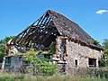
 Hayes Graves barn ruins.JPG 4,000 × 3,000; 4.3 MB
-
 Hen Ysgubor - St Margaret's Grange.jpg 4,320 × 3,240; 2.62 MB
-
 High Ground Barn - geograph.org.uk - 643831.jpg 640 × 480; 89 KB
-
 Jerusalem Mill Village Bank Barn Ruins Dec 09.JPG 2,592 × 1,944; 748 KB
-
 Nebraska Barn 01-1977.jpg 1,800 × 1,236; 1.21 MB
-
 Nebraska Barn 02-1977.jpg 1,004 × 1,500; 1.02 MB
-
 Northside of barn - geograph.org.uk - 1247026.jpg 640 × 480; 88 KB
-
 Old barn - geograph.org.uk - 1019081.jpg 640 × 480; 96 KB
-
 Old Barn and Rocks.JPG 3,456 × 2,592; 3.21 MB
-
 Old Barn, Henblas, Llangristiolus - geograph.org.uk - 38538.jpg 640 × 480; 75 KB
-
 Old barn, Llanmihangel - geograph.org.uk - 1148890.jpg 640 × 480; 148 KB
-
 Overblijfselen na de brand - Nieuw-Schoonebeek - 20364103 - RCE.jpg 1,200 × 1,200; 404 KB
-
 Overblijfselen na de brand - Nieuw-Schoonebeek - 20364104 - RCE.jpg 1,200 × 1,199; 443 KB
-
 Overblijfselen na de brand - Nieuw-Schoonebeek - 20364105 - RCE.jpg 1,200 × 1,200; 328 KB
-
 Pouch Scheune.jpg 3,648 × 2,736; 3.31 MB
-
 Preston's Barn, Lambert Lane, Settle - geograph.org.uk - 1744297.jpg 640 × 427; 365 KB
-
 Probert's Barn 1 - geograph.org.uk - 1427669.jpg 640 × 480; 247 KB
-
 Probert's Barn 2 - geograph.org.uk - 1427676.jpg 640 × 480; 131 KB
-
 Probert's Barn 3 - geograph.org.uk - 1427678.jpg 640 × 480; 256 KB
-
 Ruined barn in Holmisdale - geograph.org.uk - 1571249.jpg 640 × 480; 123 KB
-
 Ruined barn, Broadwell - geograph.org.uk - 1275705.jpg 640 × 445; 133 KB
-
 San Juan Lime Company barn-stable - San Juan Island Washington.jpg 4,000 × 3,000; 3.9 MB
-
 Snowy barn - geograph.org.uk - 494088.jpg 480 × 640; 139 KB
-

-
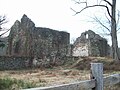
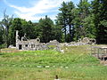 Stone Barn Ruins, Harvard Shaker Village MA.jpg 2,272 × 1,704; 2 MB
-
 Storm damaged byre-barn - geograph.org.uk - 49814.jpg 640 × 480; 108 KB
-
 Tenino, WA - derelict barn 01.jpg 4,288 × 2,848; 6.06 MB
-
 The Barn - geograph.org.uk - 800989.jpg 640 × 413; 133 KB
-
 The ruins of Ysgubor - geograph.org.uk - 402700.jpg 640 × 480; 101 KB
-
 Tumbledown barn on Brackendale Lane - geograph.org.uk - 1349797.jpg 640 × 480; 77 KB
-
 Two Kansas Barns.jpg 1,500 × 998; 1.22 MB
-
 Waikaretu barn.jpg 4,032 × 3,024; 5 MB
-
 Waikaretu barn2.jpg 4,032 × 3,024; 5.51 MB
-


.jpg)
.jpg)


