Category:Ruins of St John's Church, Chester
Jump to navigation
Jump to search
| Object location | | View all coordinates using: OpenStreetMap |
|---|
|
This is a category about scheduled monument number 1006779. |
church in Chester, Cheshire, England, UK .jpg) | |||||
| Upload media | |||||
| Instance of | |||||
|---|---|---|---|---|---|
| Location | Chester, Cheshire West and Chester, Cheshire, North West England, England | ||||
| Heritage designation |
| ||||
 | |||||
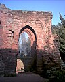
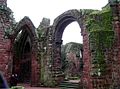
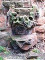
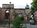
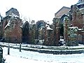
The ruined portions of St John the Baptist's Church, Chester, lie to the east and west of the 1859-66 rebuilding, the current Grade I listed church. They are a Scheduled Ancient Monument.
Media in category "Ruins of St John's Church, Chester"
The following 47 files are in this category, out of 47 total.
-

-

-
 Chester - panoramio (33).jpg 4,000 × 3,000; 3.72 MB
-
 Chester - panoramio (44).jpg 3,898 × 2,924; 3.96 MB
-
 Chester - Ruins at St John the Baptist Church - geograph.org.uk - 6330926.jpg 2,920 × 5,184; 4.73 MB
-
 Ruins of St John the Baptist's Church, Chester (1).JPG 1,024 × 1,280; 397 KB
-
 Ruins of St John the Baptist's Church, Chester (2).JPG 1,024 × 1,280; 288 KB
-

-

-
 Ruined arches - geograph.org.uk - 717728.jpg 640 × 422; 81 KB
-
-
 St John the Baptist - panoramio.jpg 1,280 × 720; 433 KB
-
 St John the Baptist 7-9-2013 (1).JPG 2,616 × 3,488; 2.1 MB
-
 St John the Baptist 7-9-2013 (2).JPG 2,616 × 3,488; 2.11 MB
-
 St John the Baptist 7-9-2013 (3).JPG 3,488 × 2,616; 2.03 MB
-
 St John the Baptist 7-9-2013 (5).JPG 2,616 × 3,488; 2.11 MB
-
 St John The Baptist Church, East Ruins - geograph.org.uk - 2156741.jpg 800 × 600; 324 KB
-

-

-

-

-

-
-
 St John the Baptist's Church, Chester 2013 (2).jpg 1,232 × 2,048; 1.14 MB
-
 St John's Chester Ruins.jpg 640 × 480; 150 KB
-
 St John's Church, Chester - Ruine 1.jpg 1,712 × 2,560; 1.45 MB
-
 St John's Church, Chester - Ruine 2 Sarg.jpg 1,712 × 2,560; 1.45 MB
-

-
 St Johns Chester 01.jpg 1,536 × 2,048; 640 KB
-
 St Johns Chester 02.jpg 1,536 × 2,048; 814 KB
-
 St Johns Chester 03.jpg 1,536 × 2,048; 702 KB
-
 St Johns Chester 04.jpg 1,536 × 2,048; 649 KB
-
 St Johns Ruins - panoramio.jpg 3,264 × 2,448; 2.48 MB
-
 St. John the Baptist Church, Chester - geograph.org.uk - 6332670.jpg 2,000 × 1,375; 2.81 MB
-
 StJohnChester11.JPG 2,816 × 2,112; 2.73 MB
-
 StJohnChester14.JPG 2,816 × 2,112; 2.94 MB
-
 StJohnChester4.JPG 2,816 × 2,112; 2.89 MB
-
 StJohnChester6.JPG 2,816 × 2,112; 2.9 MB
-
 StJohnChester7.JPG 2,112 × 2,816; 2.86 MB
-
 StJohnChester8.JPG 2,816 × 2,112; 2.66 MB
-
 StJohnChester9.JPG 2,816 × 2,112; 2.78 MB
-
 StJohnChesterA.jpg 2,816 × 1,556; 3.01 MB
-
 The Eastern Ruins - panoramio.jpg 2,048 × 1,536; 1.25 MB
-
 The Ruins at St John's Chester.jpg 5,152 × 3,864; 7.54 MB
-
 The Ruins of St John's Church, Chester - geograph.org.uk - 5389879.jpg 4,184 × 2,789; 3.96 MB
-

-
 Tro i'r De (page 36 crop).jpg 702 × 960; 182 KB

.jpg)
.jpg)

.JPG)
.JPG)


.JPG)
.JPG)
.JPG)
.JPG)


.jpg)


.jpg)