Category:Ruins in County Kerry
Jump to navigation
Jump to search
Subcategories
This category has the following 8 subcategories, out of 8 total.
A
- Ardtully House (7 F)
B
- Ballywiheen (2 F)
C
- Carrigafoyle Castle (27 F)
L
- Lislaughtin Abbey (6 F)
P
- Parkavonear Castle (12 F)
Media in category "Ruins in County Kerry"
The following 38 files are in this category, out of 38 total.
-
 Abandoned Cottage - geograph.org.uk - 981110.jpg 640 × 425; 99 KB
-
 Abandoned cottage, Gap of Dunloe - geograph.org.uk - 134060.jpg 640 × 480; 122 KB
-

-
 Abandoned dwelling in Moin an Phraoigh - geograph.org.uk - 219514.jpg 450 × 600; 131 KB
-
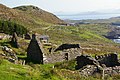
 Abandoned hamlet at Cumingeera - geograph.org.uk - 903370.jpg 640 × 425; 105 KB
-
 Abbey Island Friary - geograph.org.uk - 1391921.jpg 640 × 427; 345 KB
-
 Arbutus Cottage - geograph.org.uk - 781429.jpg 637 × 425; 87 KB
-
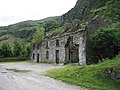
 Ardtully Castle - geograph.org.uk - 820124.jpg 640 × 480; 81 KB
-
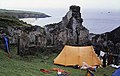 Campsite and Ruin - geograph.org.uk - 601407.jpg 640 × 406; 73 KB
-

-
 Cottages at Chapeltown - geograph.org.uk - 1399368.jpg 640 × 427; 71 KB
-
 Derelict cottage - geograph.org.uk - 546639.jpg 640 × 480; 118 KB
-
 Derelict cottages, Gap of Dunloe - geograph.org.uk - 546687.jpg 640 × 480; 111 KB
-
 Derelict farm building - geograph.org.uk - 1311200.jpg 640 × 480; 98 KB
-
 Derelict houses in the Gap of Dunloe - geograph.org.uk - 769359.jpg 640 × 480; 122 KB
-
 Derelict houses, Great Blasket ISland - geograph.org.uk - 923761.jpg 640 × 480; 190 KB
-
 Dingle-Great-Blasket-Village-2012.JPG 4,608 × 3,456; 5.17 MB
-
 Gap Cottage - geograph.org.uk - 781377.jpg 637 × 425; 128 KB
-
 Great Blasket Island.jpg 2,816 × 2,112; 2.3 MB
-
 In splendid isolation (44390803294).jpg 2,000 × 1,537; 1.03 MB
-
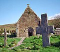 Kilmalkedar Church - geograph.org.uk - 14984.jpg 500 × 432; 52 KB
-
 Muiris house.jpg 800 × 600; 306 KB
-
 Near Lord Brandon's Cottage - geograph.org.uk - 781206.jpg 637 × 425; 97 KB
-
 Old Goods Shed, Reenard - geograph.org.uk - 1009096.jpg 640 × 426; 81 KB
-

-
 Ruin, Derrynablaha - geograph.org.uk - 292564.jpg 640 × 480; 82 KB
-
 Ruined building - geograph.org.uk - 219552.jpg 600 × 450; 73 KB
-
 Ruined chapel - geograph.org.uk - 1934974.jpg 4,000 × 3,000; 2.11 MB
-
 Ruined Cottage - geograph.org.uk - 1932254.jpg 600 × 400; 332 KB
-
 Ruined cottages - geograph.org.uk - 1009174.jpg 640 × 426; 97 KB
-
 Ruined farmhouse by the Kerry Way - geograph.org.uk - 450218.jpg 640 × 427; 128 KB
-
-
 Ruined House in the Gap of Dunloe - geograph.org.uk - 24016.jpg 640 × 480; 115 KB
-
 Saint Brendans House - geograph.org.uk - 941246.jpg 640 × 480; 91 KB
-
 Still derelict - geograph.org.uk - 781427.jpg 637 × 425; 87 KB
-
 Valencia Island lighthouse - geograph.org.uk - 1131591.jpg 640 × 427; 45 KB
-
 White Beach Great Blasket - geograph.org.uk - 635105.jpg 640 × 426; 76 KB
-
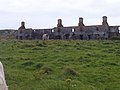
 Workhouse.jpg 2,048 × 1,536; 638 KB


,_The_Chancellor%27s_House_-_geograph.org.uk_-_275343.jpg)


.jpg)


