Category:Rugby Street
Jump to navigation
Jump to search
street in London Borough of Camden _in_October_2023.JPG) _Street_sign,_in_October_2023.JPG) | |||||
| Upload media | |||||
| Instance of | |||||
|---|---|---|---|---|---|
| Location | London Borough of Camden, Greater London, London, England | ||||
| Connects with | |||||
| Different from | |||||
 | |||||
Rugby Street
Subcategories
This category has the following 3 subcategories, out of 3 total.
Media in category "Rugby Street"
The following 15 files are in this category, out of 15 total.
-
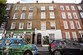
 20 Rugby Street, WC1 - geograph.org.uk - 1238215.jpg 480 × 640; 98 KB
-
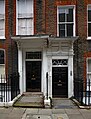
 7, Rugby Street.jpg 4,000 × 2,667; 7.7 MB
-
 9, Rugby Street.jpg 4,000 × 2,667; 7.89 MB
-
 Chapel Street Hall - later known as the Church of Humanity c.1874.png 850 × 638; 457 KB
-
 Door hoods, Rugby Street, London WC1 - geograph.org.uk - 5263411.jpg 1,219 × 1,600; 533 KB
-
 Former dairy shop, Rugby Street - geograph.org.uk - 5263361.jpg 1,600 × 1,062; 408 KB
-
 French's Dairy, Rugby Street.jpg 660 × 650; 213 KB
-
 Frenchs Dairy.jpg 4,000 × 2,667; 6.82 MB
-
 Rhinegold Publishing.jpg 2,285 × 2,630; 1.81 MB
-
 Rugby Street (London) in October 2023.JPG 4,032 × 3,024; 2.85 MB
-
 Rugby Street (London) Street sign, in October 2023.JPG 1,793 × 896; 780 KB
-
 Rugby Street and James Street on John Rocque's map of 1746.jpg 756 × 783; 872 KB
-
 Rugby Street area map.jpg 580 × 586; 207 KB
-
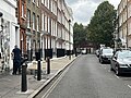
 Rugby Street, Bloomsbury - geograph.org.uk - 4693280.jpg 2,104 × 1,703; 820 KB
-
 Rugby Street, London - geograph.org.uk - 1951869.jpg 3,000 × 4,000; 2.58 MB


