Category:Rufforth
Jump to navigation
Jump to search
English: Rufforth is a village in the civil parish of Rufforth with Knapton in the unitary authority of York in North Yorkshire, England. It lies about 4 miles (6.4 km) west of York.
village in United Kingdom  | |||||
| Upload media | |||||
| Instance of | |||||
|---|---|---|---|---|---|
| Location | Rufforth with Knapton, City of York, North Yorkshire, Yorkshire and the Humber, England | ||||
 | |||||
Subcategories
This category has the following 3 subcategories, out of 3 total.
Media in category "Rufforth"
The following 28 files are in this category, out of 28 total.
-
 A Busy Sunday at Rufforth Car Boot Sale - geograph.org.uk - 5344292.jpg 995 × 686; 430 KB
-
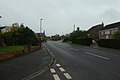
 A view Eastwards on Wetherby Road, Rufforth, North Yorkshire (12th June 2013).JPG 3,872 × 1,933; 1.25 MB
-
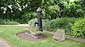
 A village water pump - geograph.org.uk - 1988664.jpg 800 × 600; 382 KB
-
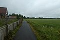
 Along Bradley Lane - geograph.org.uk - 6742154.jpg 1,024 × 683; 414 KB
-
 Along Wetherby Road (geograph 6526674).jpg 1,024 × 683; 390 KB
-

-
 Bradley Lane - geograph.org.uk - 6742159.jpg 1,024 × 683; 444 KB
-
 Bradley Lane meets Wetherby Road (geograph 6742169).jpg 1,024 × 683; 421 KB
-
 Bradley Lane near Rufforth - geograph.org.uk - 6742167.jpg 1,024 × 683; 425 KB
-
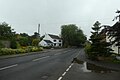 Centre of Rufforth - geograph.org.uk - 6526671.jpg 1,024 × 683; 429 KB
-
 Electricity pylons, Wetherby Road, Rufforth, North Yorkshire (12th June 2013).JPG 2,176 × 3,872; 1.58 MB
-
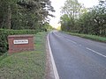 Entering Rufforth - geograph.org.uk - 3458985.jpg 1,024 × 768; 208 KB
-
 Entrance to Rufforth Park - geograph.org.uk - 3458992.jpg 1,024 × 768; 128 KB
-
 Looking along Bradley Lane - geograph.org.uk - 6742156.jpg 1,024 × 683; 435 KB
-
 Looking towards York on the B1224 at Rufforth (12th June 2013).JPG 3,872 × 2,176; 1.43 MB
-
 Low Moor Lane - geograph.org.uk - 1707776.jpg 640 × 480; 197 KB
-

-
 Passing Grasslands - geograph.org.uk - 6742161.jpg 1,024 × 683; 430 KB
-
 Path to the centre of Rufforth - geograph.org.uk - 6526669.jpg 1,024 × 683; 427 KB
-
 Post box in Rufforth (geograph 6742170).jpg 1,024 × 683; 510 KB
-
 Rufforth1.jpg 3,264 × 2,448; 884 KB
-
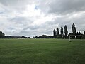 Sports pitches at Rufforth - geograph.org.uk - 5450523.jpg 1,600 × 1,200; 367 KB
-
 Telephone Box, Rufforth (12th June 2013).JPG 2,176 × 3,872; 2.81 MB
-
 Village pump - geograph.org.uk - 703695.jpg 480 × 640; 146 KB
-
 Water pump, Rufforth (12th June 2013).JPG 3,872 × 2,176; 3.98 MB
-
 Wetherby Road, Rufforth, North Yorkshire (12th June 2013).JPG 2,176 × 3,872; 1.88 MB
-
 Woodhouse Farm - geograph.org.uk - 187992.jpg 640 × 480; 76 KB
-
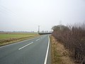
 B1224 - geograph.org.uk - 184492.jpg 640 × 479; 56 KB

.JPG)


.jpg)


.jpg)


.JPG)


.JPG)

.jpg)


.jpg)


.JPG)

.JPG)
.JPG)

