Category:Rue Génistre
Jump to navigation
Jump to search
thoroughfare in Ville Haute, Luxembourg  | |||||
| Upload media | |||||
| Instance of | |||||
|---|---|---|---|---|---|
| Named after |
| ||||
| Location | Ville Haute, Luxembourg, Canton of Luxembourg, Luxembourg | ||||
| Start time |
| ||||
| Length |
| ||||
| Elevation above sea level |
| ||||
 | |||||
Subcategories
This category has the following 2 subcategories, out of 2 total.
B
E
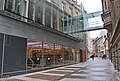
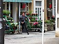
Media in category "Rue Génistre"
The following 13 files are in this category, out of 13 total.
-
 4 rue Genistre Luxembourg city 2011-05.jpg 2,376 × 1,782; 1.16 MB
-
 4 rue Genistre Luxembourg city 2012-08.JPG 4,650 × 2,775; 3.23 MB
-
 4 rue Genistre Luxembourg city portal 2012-08.JPG 5,184 × 3,456; 5.39 MB
-
 BibliothéikStadLëtzebuerg01.jpg 4,362 × 2,960; 1.27 MB
-
 Filmmaking Josy Welter.JPG 4,608 × 3,456; 5.55 MB
-
 Luxembourg, rue Génistre, Lantergässelchen - nom de rue.jpg 5,847 × 3,899; 3.24 MB
-
 Schëld Lantergässelchen, nieweneneen.jpg 3,139 × 2,354; 5.16 MB
-
 Iwwer der Lantergässelchen.jpg 4,467 × 3,493; 6.42 MB
-

-
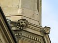 Mascaron um Zerkel-101.jpg 1,104 × 828; 714 KB
-
 Plack Archevêché.jpg 1,941 × 1,322; 2.07 MB
-
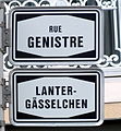 Plack Lantergässelchen.jpg 2,344 × 2,541; 3.65 MB
-
 Бенилюкс - panoramio (47).jpg 4,288 × 2,848; 5.18 MB


_%26_Rue_Genistre_(Rue_J._Jacquemart-Jans).jpg)


.jpg)