Category:Rubh'a' Mhàil
Jump to navigation
Jump to search
Rubh'a' Mhàil is the northernmost location on Islay. It is better known in English in its transliterated spoken form, Ruvaal. The buildings supporting the lighthouse are located on a flat place at the foot of Cnoc na Faire. The rocks below it are Bogha na Bainnse.
Media in category "Rubh'a' Mhàil"
The following 12 files are in this category, out of 12 total.
-
 Dyke near Rubh'a' Mhàil - geograph.org.uk - 989728.jpg 640 × 480; 125 KB
-
 Path to Rubh'a' Mhàil - geograph.org.uk - 989688.jpg 640 × 480; 91 KB
-
 Quay, Rubh'a' Mhàil - geograph.org.uk - 760129.jpg 640 × 480; 71 KB
-
 Raised beach, Rubh'a' Mhàil - geograph.org.uk - 989705.jpg 640 × 480; 106 KB
-
 Rubh'a' Mhàil from Sgarbh Breac - geograph.org.uk - 990420.jpg 640 × 480; 92 KB
-
 Rubh'a' Mhàil, raised beach - geograph.org.uk - 989691.jpg 640 × 480; 93 KB
-
 Sea cliffs and gully near Rubha A'Mhail - geograph.org.uk - 934903.jpg 640 × 452; 108 KB
-

-
 Sound of Islay from Rubh'a' Mhàil - geograph.org.uk - 989697.jpg 640 × 480; 80 KB
-
 Triangulation Pillar, Rubh'a' Mhàil - geograph.org.uk - 989699.jpg 640 × 480; 52 KB
-
 Uamh nan Lasgairean - geograph.org.uk - 761482.jpg 480 × 640; 113 KB
-
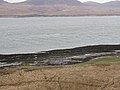
 Wind against tide, Rubh'a' Mhàil - geograph.org.uk - 989702.jpg 640 × 480; 58 KB


