Category:Roxbury, Wisconsin
Jump to navigation
Jump to search
Main Wikipedia article: Roxbury, Wisconsin.
civil town in Dane County, Wisconsin   | |||||
| Upload media | |||||
| Instance of |
| ||||
|---|---|---|---|---|---|
| Location | Dane County, Wisconsin | ||||
| Population |
| ||||
| Area |
| ||||
| Elevation above sea level |
| ||||
| official website | |||||
 | |||||
Subcategories
This category has the following 3 subcategories, out of 3 total.
Media in category "Roxbury, Wisconsin"
The following 52 files are in this category, out of 52 total.
-
 Aldens Corners - panoramio.jpg 4,896 × 3,672; 4.39 MB
-
 Ballweg Farm - panoramio (1).jpg 4,573 × 2,494; 5.75 MB
-
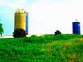
 Barn and a Silo - panoramio.jpg 4,608 × 3,456; 3.19 MB
-
 Bruenig Dairy Farm - panoramio.jpg 4,608 × 3,456; 2.86 MB
-
 Bruenig's Misty Valley Farms - panoramio.jpg 4,000 × 3,000; 2.7 MB
-
 Charles Schuchartt Farmstead - panoramio.jpg 4,608 × 3,456; 3.37 MB
-
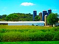
 Dairy Farm in the Town of Roxbury - panoramio.jpg 4,608 × 3,456; 3.14 MB
-
 Dairy Farm near Sauk City - panoramio.jpg 3,969 × 2,816; 2.8 MB
-
 Dane County Farmland - panoramio (3).jpg 4,896 × 3,672; 5.73 MB
-
 Dane County Wisconsin incorporated and unincorporated areas Roxbury highlighted.svg 1,140 × 540; 4.53 MB
-
 Farm near Roxbury - panoramio.jpg 4,329 × 2,222; 4.83 MB
-
 Farm on Hwy KP with Two Silos - panoramio.jpg 4,608 × 3,456; 4.45 MB
-
 Farm on Inama Rd - panoramio.jpg 4,608 × 3,456; 3.6 MB
-
 Farm South of Roxbury - panoramio.jpg 3,535 × 2,316; 3.13 MB
-
 Farm with Four Silos - panoramio (2).jpg 4,608 × 3,456; 2.65 MB
-
 Farm with many Harvestore® Silos - panoramio.jpg 4,000 × 3,000; 2.93 MB
-
 Farm With Three Silos - panoramio.jpg 4,000 × 3,000; 3.32 MB
-
 Farm with Three Silos two are Harvestore® Silos - panoramio.jpg 4,608 × 3,456; 7.66 MB
-
 Farm with Two Silos - panoramio (12).jpg 4,000 × 2,599; 2.72 MB
-
 Final Touch Sod Farm - panoramio.jpg 4,608 × 3,456; 3.28 MB
-
 Frederica and John Brosemer Farmstead - panoramio (1).jpg 5,147 × 2,994; 4 MB
-
 Frederica and John Brosemer Farmstead - panoramio.jpg 4,608 × 3,456; 8.53 MB
-
 Ganser's Motel - panoramio.jpg 4,608 × 3,456; 3.16 MB
-
 Gansers Motel - panoramio.jpg 4,000 × 3,000; 3.56 MB
-
 Gmeinder Farm - panoramio.jpg 4,608 × 3,456; 5.59 MB
-
 H ^ K Construction - panoramio.jpg 4,000 × 3,000; 4.93 MB
-
 Hirschberg Family Farm - panoramio.jpg 4,000 × 3,000; 3.17 MB
-
 House that was a Former Barn - panoramio.jpg 4,608 × 3,456; 3.76 MB
-
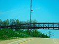 Ice Age Trail Bridge - panoramio.jpg 4,608 × 3,456; 6.69 MB
-
 Joint School District ^3 Building - panoramio.jpg 4,608 × 3,456; 8.88 MB
-
 Lafollette Farm - panoramio.jpg 4,608 × 3,456; 10.82 MB
-
 Mosquito Island - panoramio.jpg 5,184 × 3,888; 6.66 MB
-
 Pond off Kippley Road - panoramio.jpg 4,000 × 3,000; 4.72 MB
-
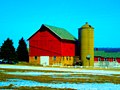 Red Barn with a Silo - panoramio.jpg 4,608 × 3,456; 3.37 MB
-
 Rocky Hill Farm l - panoramio.jpg 4,608 × 3,456; 6.06 MB
-
 Rocky Hill Farm ll - panoramio.jpg 4,608 × 3,456; 4.02 MB
-
 Rocky Hill Farm lll - panoramio.jpg 4,608 × 3,456; 5.2 MB
-
 Roxbury Cell Tower - panoramio.jpg 4,000 × 3,000; 2.66 MB
-
 Roxbury Town Hall - panoramio.jpg 4,000 × 3,000; 3.4 MB
-
 Roxbury Township - panoramio.jpg 4,000 × 3,000; 3.25 MB
-
 Roxbury Township Farm - panoramio (1).jpg 4,000 × 3,000; 3.09 MB
-
 Roxbury Township Farm - panoramio.jpg 3,490 × 2,799; 2.58 MB
-
 Roxbury Township Garage - panoramio.jpg 4,000 × 3,000; 3.47 MB
-
 Roxbury Wisconsin - panoramio.jpg 4,000 × 3,000; 3.69 MB
-
 Sauk Prairie Abandoned Railroad Pony truss Bridge - panoramio.jpg 4,608 × 3,456; 5.02 MB
-
 Slimy Pond - panoramio.jpg 4,000 × 3,000; 3.83 MB
-
 Snuffy's Family Campgrounds - panoramio.jpg 4,844 × 2,854; 4.94 MB
-
 Springfield Hill Cell Tower - panoramio.jpg 5,184 × 3,888; 4.89 MB
-
 Steve's Arboretum Lounge - panoramio.jpg 3,985 × 2,495; 4.68 MB
-
 TownOfRoxburyDaneCtWI.png 800 × 606; 129 KB
-
 WIMap-doton-Roxbury.png 292 × 310; 26 KB
-
 Wisconsin River and Round Top Hill - panoramio.jpg 4,000 × 3,000; 3.65 MB

.jpg)


.jpg)


.jpg)


.jpg)

.jpg)


.jpg)


